Skycatch And DJI Announce Global Agreement | Aero-News Network
Aero-News Network
RSS icon RSS feed
podcast icon MP3 podcast
Subscribe Aero-News e-mail Newsletter Subscribe

Airborne Unlimited -- Most Recent Daily Episodes

Episode Date

Airborne-Monday

Airborne-Tuesday

Airborne-Wednesday Airborne-Thursday

Airborne-Friday

Airborne On YouTube

Airborne-Unlimited-05.05.25

Airborne-NextGen-05.06.25

AirborneUnlimited-05.07.25

Airborne-Unlimited-05.01.25

AirborneUnlimited-05.02.25

Thu, Mar 29, 2018

Skycatch And DJI Announce Global Agreement

Will Deliver High-Precision Custom Drones For Komatsu Smart Construction Service

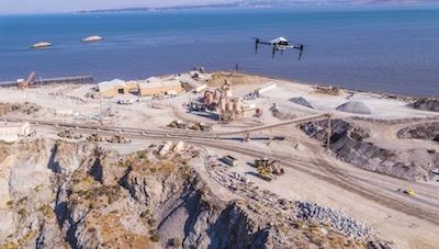
Commercial drone data company Skycatch, and DJI have extended their partnership to manufacture and deliver a fleet of high-precision drones for Komatsu Smart Construction. Each drone is manufactured by DJI and outfitted with specialized Skycatch technology, and is the first time DJI has manufactured a custom drone for a partner.

The Skycatch Explore1 drone autonomously flies over job sites to create highly accurate 3D site maps and models and will be deployed on Komatsu job sites. This map data will be used for Komatsu Smart Construction’s new data service that enables robotic earth moving equipment, used in the earthwork stage of the construction process, to correctly dig, bulldoze, and grade land autonomously according to digital construction plans.

“Conducting a site survey using a drone used to take hours. However, by implementing Explore1, users can carry out surveying quickly and easily. Now it is possible to perform drone surveying every day. Taking off, landing and flight route setting are all automated. Ground Control Points (GCPs) are no longer needed. 3D data is immediately generated and an entire construction site can be visually checked with the 3D map. The Explore1 is a true game changer for the construction site,” said Chikashi Shike, Executive Office of Smart Construction Division at Komatsu.

The Explore1 drone is built on DJI’s customizable Matrice 100 enterprise drone platform and is part of Skycatch’s High Precision Package along with the Edge1 RTK base station, a highly powerful ruggedized computer with software that locally processes drone images into precise 3D models regardless of wireless connectivity and location. Together, these technologies enable firms to create highly accurate maps and point clouds, discover costly job site mistakes, and predict schedule delays, saving up to tens of thousands of dollars per week.

“Being the first company to integrate into DJI’s manufacturing process will deliver incredible value to our customers worldwide,” said Christian Sanz, CEO at Skycatch. “By combining DJI’s mastery of hardware manufacturing and aerial technology with Skycatch’s data processing and customer expertise, we’ve created the most powerful and comprehensive solution for enterprise customers everywhere.”

“The Explore1 demonstrates DJI’s strategy to provide customers with the most powerful and reliable drone platforms on the market that can be tailored to the needs of any industry,” said Jan Gasparic, Head of Enterprise Partnerships at DJI. “Our close collaboration with Skycatch on this exciting program has resulted in a best-in-class solution of software and hardware for aerial surveying that truly changes the game for both our customers and the commercial drone industry.”

(Source: DJI news release. Image provided)

FMI: www.dji.com

Advertisement

More News

ANN's Daily Aero-Linx (05.06.25)

Aero Linx: International Federation of Airworthiness (IFA) We aim to be the most internationally respected independent authority on the subject of Airworthiness. IFA uniquely combi>[...]

ANN's Daily Aero-Term (05.06.25): Ultrahigh Frequency (UHF)

Ultrahigh Frequency (UHF) The frequency band between 300 and 3,000 MHz. The bank of radio frequencies used for military air/ground voice communications. In some instances this may >[...]

ANN FAQ: Q&A 101

A Few Questions AND Answers To Help You Get MORE Out of ANN! 1) I forgot my password. How do I find it? 1) Easy... click here and give us your e-mail address--we'll send it to you >[...]

Classic Aero-TV: Virtual Reality Painting--PPG Leverages Technology for Training

From 2019 (YouTube Edition): Learning To Paint Without Getting Any On Your Hands PPG's Aerospace Coatings Academy is a tool designed to teach everything one needs to know about all>[...]

Airborne 05.02.25: Joby Crewed Milestone, Diamond Club, Canadian Pilot Insurance

Also: Sustainable Aircraft Test Put Aside, More Falcon 9 Ops, Wyoming ANG Rescue, Oreo Cookie Into Orbit Joby Aviation has reason to celebrate, recently completing its first full t>[...]

blog comments powered by Disqus


Advertisement

Advertisement

Podcasts

Advertisement

© 2007 - 2025 Web Development & Design by Pauli Systems, LC