NASA, ULA Launch Mission To Track Earth's Changing Ice | Aero-News Network
Aero-News Network
RSS icon RSS feed
podcast icon MP3 podcast
Subscribe Aero-News e-mail Newsletter Subscribe

Airborne Unlimited -- Most Recent Daily Episodes

Episode Date

Airborne-Monday

Airborne-Tuesday

Airborne-Wednesday Airborne-Thursday

Airborne-Friday

Airborne On YouTube

Airborne-Unlimited-05.05.25

Airborne-NextGen-05.06.25

AirborneUnlimited-05.07.25

Airborne-Unlimited-05.01.25

AirborneUnlimited-05.02.25

Tue, Sep 18, 2018

NASA, ULA Launch Mission To Track Earth's Changing Ice

ICESat-2 Boosted Into Orbit In ULA's Final Delta II Rocket Launch

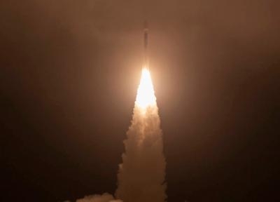
NASA’s Ice, Cloud and land Elevation Satellite-2 (ICESat-2) successfully launched from California at 9:02 a.m. EDT Saturday, embarking on its mission to measure the ice of Earth’s frozen reaches with unprecedented accuracy.

ICESat-2 lifted off from Space Launch Complex-2 at Vandenberg Air Force Base on United Launch Alliance’s final Delta II rocket. Ground stations in Svalbard, Norway, acquired signals from the spacecraft about 75 minutes after launch. It’s performing as expected and orbiting the globe, from pole to pole, at 17,069 mph from an average altitude of 290 miles.

“With this mission we continue humankind’s exploration of the remote polar regions of our planet and advance our understanding of how ongoing changes of Earth’s ice cover at the poles and elsewhere will affect lives around the world, now and in the future,” said Thomas Zurbuchen, associate administrator of NASA’s Science Mission Directorate.

ICESat-2 carries a single instrument, the Advanced Topographic Laser Altimeter System (ATLAS). ATLAS will be activated approximately two weeks after the mission operations team completes initial testing of the spacecraft. Then ICESat-2 will begin work on its science objective, gathering enough data to estimate the annual height change of the Greenland and Antarctic ice sheets to within four millimeters – the width of a pencil.

“While the launch today was incredibly exciting, for us scientists the most anticipated part of the mission starts when we switch on the laser and get our first data,” said Thorsten Markus, ICESat-2 project scientist at NASA’s Goddard Space Flight Center. “We are really looking forward to making those data available to the science community as quickly as possible so we can begin to explore what ICESat-2 can tell us about our complex home planet.”

The high-resolution data will document changes in the Earth’s polar ice caps, improve forecasts of sea level rise bolstered by ice sheet melt in Greenland and Antarctica, and help scientists understand the mechanisms that are decreasing floating ice and assess how that sea ice loss affects the ocean and atmosphere.

ICESat-2 continues the record of ice height measurements started by NASA’s original ICESat mission, which operated from 2003 to 2009, that were continued by the agency’s annual Operation IceBridge airborne flights over the Arctic and Antarctic, which began in 2009. Data from ICESat-2 will be available to the public through the National Snow and Ice Data Center.

Goddard built and tested the ATLAS instrument, and manages the ICESat-2 mission for NASA’s Science Mission Directorate. Northrop Grumman designed and built the spacecraft bus, installed the instrument and tested the completed satellite. NASA’s Launch Services Program, based at Kennedy Space Center in Florida, is responsible for launch service acquisition, integration, analysis and launch management.

(Image provided with NASA news release)

FMI: www.nasa.gov/earth, www.nasa.gov

Advertisement

More News

ANN's Daily Aero-Linx (05.06.25)

Aero Linx: International Federation of Airworthiness (IFA) We aim to be the most internationally respected independent authority on the subject of Airworthiness. IFA uniquely combi>[...]

ANN's Daily Aero-Term (05.06.25): Ultrahigh Frequency (UHF)

Ultrahigh Frequency (UHF) The frequency band between 300 and 3,000 MHz. The bank of radio frequencies used for military air/ground voice communications. In some instances this may >[...]

ANN FAQ: Q&A 101

A Few Questions AND Answers To Help You Get MORE Out of ANN! 1) I forgot my password. How do I find it? 1) Easy... click here and give us your e-mail address--we'll send it to you >[...]

Classic Aero-TV: Virtual Reality Painting--PPG Leverages Technology for Training

From 2019 (YouTube Edition): Learning To Paint Without Getting Any On Your Hands PPG's Aerospace Coatings Academy is a tool designed to teach everything one needs to know about all>[...]

Airborne 05.02.25: Joby Crewed Milestone, Diamond Club, Canadian Pilot Insurance

Also: Sustainable Aircraft Test Put Aside, More Falcon 9 Ops, Wyoming ANG Rescue, Oreo Cookie Into Orbit Joby Aviation has reason to celebrate, recently completing its first full t>[...]

blog comments powered by Disqus


Advertisement

Advertisement

Podcasts

Advertisement

© 2007 - 2025 Web Development & Design by Pauli Systems, LC