Real-Time Data From Sentera FieldAgent Unlocks New Insights And Benefits Within Climate FieldView
Climate FieldView customers can now enjoy seamless integration of Sentera FieldAgent on-field sensor and analytics products with FieldView, and automatic synchronization of field boundary and other user information between platforms. The partnership between Sentera and The Climate Corporation will help growers and trusted advisors incorporate Sentera's accurate real-time on-field data into their decision process. Sentera's portfolio of integrated solutions – including sensors, drones, and FieldAgent software – will be offered through Climate FieldView dealers, making it easier than ever to make data-driven agronomic decisions that help maximize profits and increase yields.
"We are excited to partner with Climate Corporation to deliver our data products into FieldView," said Eric Taipale, CEO of Sentera. "The sooner an advisor or a grower can see how a crop is performing, the more flexibility they have to make decisions. More accurate on-field data delivered quickly helps to preserve yield, minimize costs, and contributes to overall profitability for the grower. The new data layers we're pushing to FieldView do exactly that."
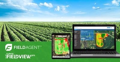
The FieldAgent and FieldView integration makes real-time data incredibly simple. Easily and autonomously scout a field with a drone and process the data using Sentera FieldAgent. When processing is complete, FieldAgent automatically synchronizes your data to FieldView, allowing you to quickly take meaningful action.
"FieldView Platform brings value to farmers, faster, by partnering with innovators across agriculture. This partnership will help our shared customers take advantage of Sentera's unique solutions in their day-to-day decision-making," said Vilas Rao, Vice President of Strategy at The Climate Corporation.
FieldAgent imagery products based on NDVI, Red Edge, and Sentera analytics and analysis tools are compatible with FieldView. Enhanced products, like elevation maps, population analysis, and weed mapping tools, allow users to further allocate inputs and practices to maximize economic benefit throughout the season.
"Availability of a turnkey hardware and software product that bundles FieldView with everything needed to produce real-time data layers – a drone, sensors, and the software necessary to make it useful – is unique in North America. We are so excited to have this product available through The Climate Corporation's dealers. A user can visit a participating Climate FieldView dealer and leave with a complete crop-scouting solution that will let them start generating data right away," remarked Kris Poulson, Vice President of Agriculture at Sentera.
"Users can be confident that the entire end-to-end solution – from sensor, to drone, to FieldAgent integration with FieldView – will be easy and seamless. The partnership between Sentera and Climate Corporation will give incredible new insights for advisors and growers."
The Sentera FieldAgent platform includes mobile, web, cloud and desktop components. A hybrid in-field and cloud processing model efficiently manages real-time data production for your real-world conditions. In-field analytics include weed maps, population analysis, elevation maps, zone mapping, and more.
(Image provided with Sentera news release)
 ANN's Daily Aero-Term (05.09.24): Hold Procedure

