ESA's Sentinel-2 Delivers First Images | Aero-News Network
Aero-News Network
RSS icon RSS feed
podcast icon MP3 podcast
Subscribe Aero-News e-mail Newsletter Subscribe

Airborne Unlimited -- Most Recent Daily Episodes

Episode Date

Airborne-Monday

Airborne-Tuesday

Airborne-Wednesday Airborne-Thursday

Airborne-Friday

Airborne On YouTube

Airborne-Unlimited-05.06.24

Airborne-NextGen-05.07.24

Airborne-Unlimited-05.08.24 Airborne-FlightTraining-05.09.24

Airborne-Unlimited-05.10.24

Wed, Jul 01, 2015

ESA's Sentinel-2 Delivers First Images

Shoots 180-Mile-Wide Swath Through Central Europe, The Mediterranean

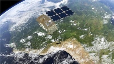
Just four days after being lofted into orbit, Europe’s Sentinel-2A satellite delivered its first images of Earth, offering a glimpse of the ‘color vision’ that it will provide for the Copernicus environmental monitoring program.

With a swath width of 290 km, the satellite’s first acquisition began in Sweden and made a strip-like observation through central Europe and the Mediterranean, ending in Algeria.

The data were relayed in real time to Italy’s Matera ground station, where teams eagerly awaited their arrival for processing.

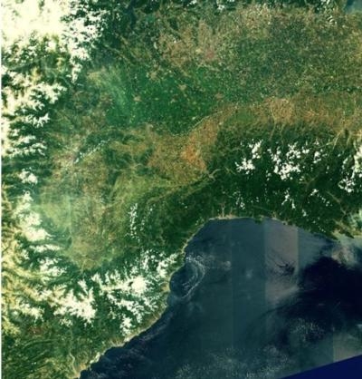
While northern and central Europe were mostly cloudy, Italy’s typical sunny weather allowed the teams to get their first glimpse of the multispectral instrument’s capabilities over the northwestern part of the country and the French Riviera – and they were excited by what they saw. With a ground resolution of 10 m per pixel, the images show individual buildings in Milan, agricultural plots along the Po River, and ports along the southern French coast.

“This new satellite will be a game changer in Earth observation for Europe and for the European Copernicus programme,” said Philippe Brunet, Director for Space Policy, Copernicus and Defence at the European Commission.

“Sentinel-2 will enable us to provide data for the program’s land monitoring services and will be the base for a wide spectrum of applications reaching from agriculture to forestry, environmental monitoring to urban planning,” said  Volker Liebig, the Director of ESA’s Earth Observation Programs.

The multispectral imager is being calibrated during the commissioning phase – which will take about three months to complete – but the quality of these first images already exceeds expectations.

In addition to demonstrating the imager’s high resolution, these initial data also foreshadow the mission’s land-monitoring applications in areas such as agriculture, inland and coastal waters and land-cover mapping.

The imager’s 13 spectral bands, from the visible and the near infrared to the shortwave infrared at different spatial resolutions, take land monitoring to an unprecedented level. In fact, Sentinel-2 is the first optical Earth observation mission of its kind to include three bands in the ‘red edge’, which provide key information on the state of vegetation.

This weekend’s activities also demonstrated that the operational processor works flawlessly, paving the way for the mission’s systematic data generation to come.

Sentinel-2A is the second satellite for Europe’s Copernicus program, following the Sentinel-1A radar satellite launched last year.

Designed as a two-satellite mission, Sentinel-2 will provide optical imagery on a five-day revisit cycle once its twin, Sentinel-2B, is launched in 2016.

(Images provided by ESA)

FMI: www.esa.int

Advertisement

More News

Aero-News: Quote of the Day (05.09.24)

"Fly-by-wire flight, coupled with additional capability that are being integrated into ALFA, provide a great foundation for Bell to expand on its autonomous capabilities. This airc>[...]

ANN's Daily Aero-Term (05.09.24): Hold Procedure

Hold Procedure A predetermined maneuver which keeps aircraft within a specified airspace while awaiting further clearance from air traffic control. Also used during ground operatio>[...]

ANN's Daily Aero-Linx (05.09.24)

Aero Linx: B-21 Raider The B-21 Raider will be a dual-capable penetrating strike stealth bomber capable of delivering both conventional and nuclear munitions. The B-21 will form th>[...]

Airborne 05.03.24: Advanced Powerplant Solutions, PRA Runway Woes, Drone Racing

Also: Virgin Galactic, B-29 Doc to Allentown, Erickson Fire-Fighters Bought, FAA Reauthorization After dealing with a big letdown after the unexpected decision by Skyreach to disco>[...]

Airborne-NextGen 05.07.24: AI-Piloted F-16, AgEagle, 1st 2 WorldView Sats

Also: Skydio Chief, Uncle Sam Sues, Dash 7 magniX, OR UAS Accelerator US Secretary of the Air Force Frank Kendall was given a turn around the patch in the 'X-62A Variable In-flight>[...]

blog comments powered by Disqus


Advertisement

Advertisement

Podcasts

Advertisement

© 2007 - 2024 Web Development & Design by Pauli Systems, LC