Blue Hawaiian Helicopters Selects G500H, Upgrades Their
Fleet
One of Garmin's most popular products for helicopters is being
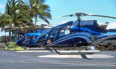
used by one of the world’s largest tour operators. Blue
Hawaiian, the largest Hawaiian helicopter operator and
Hollywood’s first-call helicopter company, is in the process
of installing the Garmin G500H in their fleet of 21 Eurocopter
EC130 and AS350 helicopters.
“The greatest risk factor faced by helicopter operations
in Hawaii is inadvertent flight into IMC and subsequent CFIT
(controlled flight into terrain). Garmin’s synthetic vision
technology is a god-send. The G500H is a revolutionary tool to
improve situational awareness and significantly reduce our greatest
risk. The cost/benefit of this system makes this choice a
‘no-brainer,’” said David Chevalier, CEO, Blue
Hawaiian Helicopters. “Having a customer like Blue Hawaiian
– who goes the extra mile to have the most advanced 21st
century helicopter technology – select the G500H speaks
volumes about the impression this product is making on the
helicopter industry,” said Gary Kelley, Garmin’s vice
president of marketing. “With the availability of an advanced
avionics system like the G500H, helicopter pilots will have
unparalleled safety of flight and situational awareness, and will
be able to provide their customers with the best experience in the
air.”
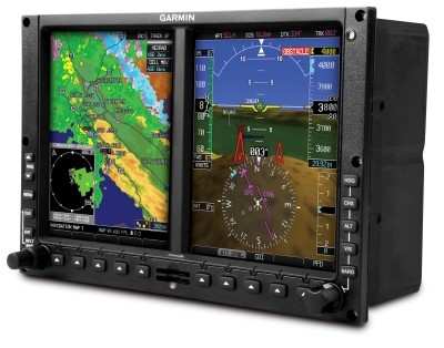
Dual 6.5-inch LCD screens, mounted side-by-side in a single
bezel, put primary flight display (PFD) and multi-function display
(MFD) capabilities right in front of the pilot. The PFD screen
shows attitude, airspeed, altitude, climb rate and course/heading
information — while the MFD provides detailed moving-map
graphics depicting the helicopter’s current position in
relation to ground features, chart data, navaids and flight plan
routings.
The G500H is available in two versions – one with the PFD
on the right, the other version with the PFD on the left –
allowing maximum installation versatility. The G500H has numerous
advanced technologies that are optimized for rotorcraft. The G500H
supports Garmin’s helicopter-specific synthetic vision
technology (HSVT) that lets pilots see an
“out-the-window” view of the surroundings and traffic,
regardless of the weather conditions. HSVT seamlessly blends
information about the rotorcraft’s position with topographic
databases to create and display real-time 3D images.
To help monitor the aircraft’s location on unfamiliar
airports, the G500H comes with preloaded geo-referenced SafeTaxi
diagrams for nearly 1,000 U.S. airports, as well as a
helicopter-specific databases with over 7,000 heliports and nearly
30,000 additional low-altitude obstacles. In addition, it supports
optional equipment that enables XM WX Satellite Weather with
NEXRAD, GSR 56 Iridium transceiver for aircraft tracking, and the
ability to display video from a forward looking infrared (FLIR)
camera or other video sources. Blue Hawaiian completed its first
two G500H installation in late 2010, and has already put hundreds
of hours on the aircraft with the new avionics. The company plans
to upgrade the entire fleet to G500H by mid- 2011.
 ANN's Daily Aero-Linx (05.02.24)

