Accident NOT The Result Of A Midair
 Editor's Note:
Below is the complete, unedited text of the National Transportation
Safety Board's Preliminary Report on the October 18 crash of a
Piper PA-42 Cheyenne III near Prescott, AZ.
Editor's Note:
Below is the complete, unedited text of the National Transportation
Safety Board's Preliminary Report on the October 18 crash of a
Piper PA-42 Cheyenne III near Prescott, AZ.
As Aero-News
reported, the plane crashed after manuevering
below a Mig-21 to check on a landing gear issue on the Mig. The
Cheyenne, with five persons onboard, was participating in a photo
shoot with the Russian fighter at the time of the accident. All
five were lost when the Piper went down; the pilot of the MiG was
able to land safely.
Initial reports stated the two aircraft collided in
midair -- easy to understand, given the circumstances -- but the
NTSB states a midair collision was NOT the cause of the loss of the
Piper. For as-yet undetermined reasons, the Cheyenne apparently
lost its vertical stabilizer while maneuvering... but the two
planes did not touch.
NTSB Identification: LAX07FA012
14 CFR Part 91: General Aviation
Accident occurred Wednesday, October 18, 2006 in Perkinsville,
AZ
Aircraft: Piper PA-42, registration: N121CS
Injuries: 5 Fatal.
This is preliminary information, subject to change, and may
contain errors. Any errors in this report will be corrected when
the final report has been completed.
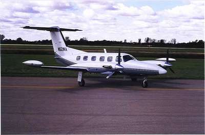
On October 18, 2006, at 1347 mountain standard time, a Piper
PA-42 (Cheyenne III, file photo of type, center), N121CS, was
destroyed when its tail section separated in flight while
maneuvering about 16 nautical miles northeast of Prescott, Arizona.
The airline transport pilot and four passengers sustained fatal
injuries and the airplane was destroyed. The airplane was operated
by the pilot under the provisions of 14 CFR Part 91 as an aerial
photography flight. Visual meteorological conditions prevailed and
a flight plan was not filed for the local flight that departed the
Ernest A. Love Field, Prescott, about 15 minutes before the
accident.
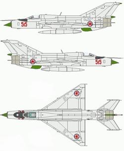
The intent of the flight was to take aerial photographs of a MiG
21 airplane (N21UT). The pilot of the MiG 21 indicated that he and
the Cheyenne pilot discussed the photo flight the day of the
accident, and had established 2,500 to 3,000 feet above ground
level (agl) as their minimum altitude and 200 knots as their
minimum airspeed. The MiG and Cheyenne pilot did not establish a
minimum separation distance, as it was not intended to be a
formation flight. The MiG pilot reported that they intended on
adjusting the in-flight separation as the flight progressed.
The MiG pilot reported that he departed the Prescott airport and
flew straight out on a northeast heading. On departure, he
experienced a problem retracting the landing gear and noted that
only the nose landing gear successfully retracted. He recycled the
landing gear handle from up to off and back to the up position, and
received a successful gear retraction indication. He notified the
Cheyenne pilot of the landing gear problem, but informed him that
he believed the landing gear was retracted. The Cheyenne pilot
indicated that they would join up with the MiG, look it over and
check-out the landing gear, and let the MiG pilot know what they
saw.
The MiG pilot flew the airplane at 9,000 feet mean sea level
(msl) in a 30-degree right-hand turn at 200 knots with approach
flaps selected (approximately 25 degrees). He continued to circle
in that configuration to allow the Cheyenne to rendezvous with the
MiG. The MiG pilot reported that he observed the Cheyenne meet up
at his 5 o'clock position about 300-400 feet behind him about the
same altitude. The MiG pilot looked forward and when he looked back
to the Cheyenne, he could not see it. About 30 seconds later, he
heard the Cheyenne pilot comment about the right landing gear or
gear door, but the statement was not completed. The MiG pilot
waited to hear back from the Cheyenne pilot, but when he did not
receive any additional information, he asked the Cheyenne pilot to
repeat because he didn't understand the last transmission. The
Cheyenne pilot did not respond and the MiG pilot never received
additional information.
The MiG pilot continued flying in that manner and tried to reach
the Cheyenne over the radio. After a couple of minutes he observed
a column of smoke rising from the desert terrain and became
concerned about the Cheyenne. The MiG pilot called the Prescott air
traffic controller and asked if they were receiving an emergency
locator transmitter (ELT) because he could not see the Cheyenne,
could not reach him over the radio, and could now see a column of
smoke in the area in which they were flying. The controller
reported that they were not receiving an ELT signal but asked for
coordinates for the smoke so they could send someone to check it
out. The MiG pilot provided the coordinates and flew around a while
longer to burn off fuel prior to landing. He informed the
controller that he was having problems with his landing gear so the
controller cleared him for the option.
 The MiG pilot landed
uneventfully. The MiG was later inspected for contact with the
Cheyenne but no evidence of contact between the two airplanes was
noted.
The MiG pilot landed
uneventfully. The MiG was later inspected for contact with the
Cheyenne but no evidence of contact between the two airplanes was
noted.
A statement provided by the Prescott airport manager indicated
that he was listening to both aircraft as they taxied and departed
the airport. He then switched frequencies to the air-to-air
frequency used by the MiG and Cheyenne pilot (123.45). He reported
hearing the conversation between the MiG and the Cheyenne pilots,
and then heard the Cheyenne pilot indicate that he would "drop down
and go underneath and let you know how it looks" after the MiG
pilot informed him that he had recycled his landing gear and
believed they were retracted.
Radar data from the Seligman, Arizona, RADES facility depicted
the MiG in a right-hand turn. The Cheyenne joined up with the MiG
on the inside of the turn and descended from above the MiG to below
it. The Cheyenne's flight path matched that of the MiG and its last
radar return with altitude information depicted both aircraft at
7,900 feet msl at 1346:47.
The Cheyenne's main wreckage (which included the entire aircraft
with the exception of the upper half of the vertical stabilizer,
horizontal stabilizer, and elevator) was located at a global
positioning system (GPS) measured location of 34 degrees 52.821
minutes north latitude and 112 degrees 15.197 minutes west
longitude at a terrain elevation of 4,366 feet msl. The main
wreckage came to rest on a heading of 230 degrees, in an inverted
position, and had sustained fire damage throughout its entirety
with the exception of the aft empennage, lower vertical stabilizer,
and rudder. The fuselage and wing skin had melted allowing
investigators to trace the control cables from the cockpit to the
ailerons, rudder, and base of the elevator pushrod. No anomalies
with the cables were noted. In addition, the engine controls were
traced from the cockpit to their respective engines.
The T-tail section of the airplane came to rest at a GPS
measured location of 34 degrees 52.420 minutes north latitude and
112 degrees 15.241 minutes west longitude at a terrain elevation of
4,466 feet msl. The tail section included the upper portion of the
vertical stabilizer, the horizontal stabilizer and elevator, which
all remained intact and came to rest on the topside of the
horizontal stabilizer/elevator. The tail section did not sustain
any fire damage, and was missing the left elevator counter weight.
Movement of the elevator reveled no binding or pre-existing
anomalies.
On October 20, 2006, the tail section was transported to the
main wreckage where they were examined together. Examination of the
vertical stabilizer's front and aft spars revealed that they were
bent and twisted to the right. The rudder was twisted to the right
about 180 degrees. All fracture surfaces on the vertical stabilizer
and elevator vertical push-pull tube were irregular and deformed
and did not display any evidence of fatigue cracking or
pre-existing failures.
 ANN's Daily Aero-Term (05.07.25): Terminal Radar Service Area

