Will Use Drone For Surveying And Quantity Measurement For Mines, Quarries
Delair, a supplier of commercial drone solutions, along with one of its regional resellers, Frontier Precision, has announced that Wood has adopted the Delair UX11 high-performance UAV for its work in site planning and asset management in mining and quarry projects in the western U.S.
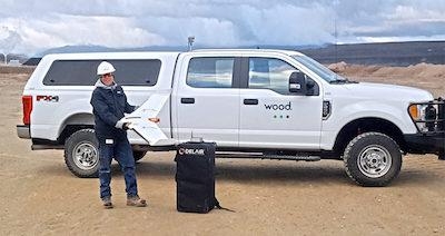
Wood – a company providing engineering and technical services to the energy, industry and built environment sectors – is initially deploying the drone to do high accuracy, 3D topographic surveys and materials quantification for mineral mining in Idaho and Wyoming. It is the first fixed-wing UAV Wood has deployed in the Western U.S.
“For the scale of the projects we are performing, and the accuracy required, adopting the Delair UX11 was a logical choice. Its long-range capabilities allow us to cover areas not feasible with other data collection methods like hover craft drones or by foot, so it reduces the cost and time involved. It integrates well with our existing work flows, and features such as the PPK function deliver additional benefits in terms of the precision and flexibility required in challenging environments,” said Greg Meinecke, Technical Services Manager at Wood. “We have received excellent support from Frontier Precision and Delair in helping us deploy our first fixed-wing UAV missions and are already seeing results.”
Wood is deploying the drone in remote areas where its heavy civils team is performing extensive excavation and site preparation for phosphate mining activities, a project covering more than 200 acres. Of critical importance for operations is an ability to precisely quantify the volume of materials being removed to ensure a high degree of accuracy in planning and invoicing.
Wood turned to the Delair fixed-wing UAV to deal with the scale of the terrain that needed to be surveyed, as well as the challenge of taking measurements in an active mine site area, including the safety hazards of having personnel on the ground in rough terrain and around large, moving equipment. Flying at 400 feet above the project areas and often at times using beyond visual line of sight (BVLOS) flight plans, Wood technicians were able to use the precision data collection features of the Delair UX11 to acquire large amounts of highly accurate imagery that could be processed to generate detailed topographical reports.
“We are able to get surveys covering large tracts of land done in a very short amount of time, so it ends up being much more cost effective for us and the client. More importantly, we can provide the mine owners a great deal of confidence in the accuracy of the work being performed and the quantities of resources involved. In the end, everyone agreed on the material quantities as the technology is very reliable,” Meinecke said.
Frontier Precision worked alongside Wood’s engineering and field experts to evaluate the Delair drone, and ensure it met the firm’s requirements, including integration with other important tools the firm uses such as AutoCad, Trimble Business Center, and the Pix4D photogrammetry suite.
Wood’s team noted the ease of use of the Delair UAV, especially given this was their first experience with fixed-wing flying. The firm was able to train several pilots who specialize in different types of projects, and expects to deploy the drone on other infrastructure, mining and construction projects around the U.S. The team also noted the Delair UX11’s embedded global shutter camera as well as its PDK (post processed kinematic) capabilities as key to ensuring greater precision in its data collection. With PPK, GPS data from both on-board and off-board systems can be matched after the mission, providing higher degrees of accuracy of the images collected.
The Delair UX11 UAV, introduced commercially last year, is one of Delair’s top-of-the-line drones. The fixed-wing drone is an innovative hardware-software platform that provides highly accurate images for survey-grade mapping, with on-board processing capabilities and real-time, long-range control via 3G/4G cellular networks or radio links. The platform’s enhanced centimeter-level precision along with its efficient operational characteristics make it the most cost-effective solution for large area surveying and mapping.
(Source: Delair news release)
 ANN's Daily Aero-Term (04.26.24): DETRESFA (Distress Phrase)

