Tue, May 26, 2015
Missions Range From Agriculture To Archeology
From agriculture to inspection and archeology, unmanned systems could benefit North Dakota and the surrounding region in as many ways as can be imagined, according to the speakers at an AUVSI road show held last week in Bismarck.
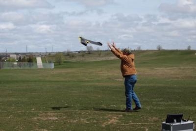
Facilitated by the Central North American Trade Corridor Association, the conference featured an outdoor demonstration by RDO Engineering, a local reseller of the senseFly eBee drone. The system was able to take off, fly through waypoints and land facing into the breeze despite the area’s unseasonable 30-degree temperatures and 20 mph winds. Though the platform was created for the agriculture sector, Jason Pearson of RDO said they’ve seen sales pick up this year in alternative areas.
“We’re selling not only to civil engineers, but also to guys that have gravel pits and stuff like that that may not know this kind of technology,” he said. The company has sold 40 platforms since May of last year in their resell area, between Minnesota and Montana.
“It’s a very good system. It’s basically a lightweight system with everything involved,” said RDO’s Brandon Ewen, who piloted the system. “We have a tablet that’s controlling it and would be connected through a UHF radio so you’re not manually flying this aircraft. “ He said he’s mapped up to 300 acres in one flight with the system.
Some companies at the event said they are flying unmanned aircraft for free, sidestepping regulations that require an exemption from the Federal Aviation Administration that prohibit commercial flight operations.
Mike Mabin’s day job is working for an advertising and marketing firm in the area, but he and a fellow coworker have formed a company called Shutter Pilots specializing in aerial 3-D animation using unmanned aircraft.
“We’re flying for free instead of for fee,” he said.
As a part of that free work, Shutter Pilots is currently mapping an area that used to house a Native American village in the late 1700s, until it was abandoned because of a smallpox outbreak. The project is using orthomosaics made by data gathered by unmanned aircraft, coupled with 3-D renderings of other known Native American earth lodges, to get an idea of what the area used to look like.
The company has applied for an exemption through the FAA and is awaiting its decision.
“We go through a very structured process every time we fly for safety and for quality purposes,” he said.
Daniel Wagner from Fargo, North Dakota’s KLJ engineering, is using a DJI Phantom to perform data collection for engineering efforts. He said many Phantom flyers are in the hobby world and don’t always keep command over the platforms. But his background as a registered land surveyor means he holds himself to a different standard.
“We’re professionals. We have a code of conduct that we have to follow,” he said. “If we don’t follow it, we can lose our license. … There’s a way to keep us accountable from having something happen.”
(Image provided by AUVSI)
More News
Aero Linx: JAARS Nearly 1.5 billion people, using more than 5,500 languages, do not have a full Bible in their first language. Many of these people live in the most remote parts of>[...]
'Airplane Bounced Twice On The Grass Runway, Resulting In The Nose Wheel Separating From The Airplane...' Analysis: The pilot reported, “upon touchdown, the plane jumped back>[...]
"Burt is best known to the public for his historic designs of SpaceShipOne, Voyager, and GlobalFlyer, but for EAA members and aviation aficionados, his unique concepts began more t>[...]
"Polaris Dawn, the first of the program’s three human spaceflight missions, is targeted to launch to orbit no earlier than summer 2024. During the five-day mission, the crew >[...]
There Are SO Many Ways To Get YOUR Aero-News! It’s been a while since we have reminded everyone about all the ways we offer your daily dose of aviation news on-the-go...so he>[...]
 ANN's Daily Aero-Linx (05.04.24)

