Flew 25 Missions Assessing The Storm As It Developed And Rolled Up The U.S. East Coast
The Air Force Reserve’s 53rd Weather Reconnaissance Squadron, aka the Hurricane Hunters, have flown 25 missions, from Aug. 25 to their last, Sept. 6, in support of Hurricane Dorian.
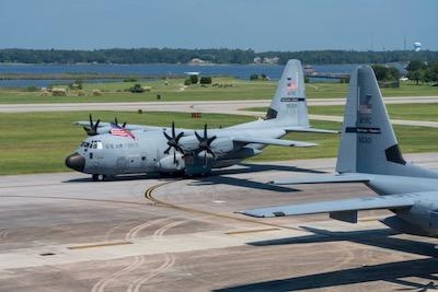
Operations began with three WC-130J aircrafts and one C-130J Super Hercules aircraft from the 403rd Wing departing Keesler Air Force Base, Aug. 25, for Curaçao to provide weather reconnaissance support of what was then Tropical Storm Dorian.
The three weather crews, assigned to the 53rd WRS, had been flying fixed missions out of Curaçao the night of Aug. 26, said Maj. Kendall Dunn, 53rd WRS pilot. The tactical airlift crew, assigned to the 815th Airlift Squadron, carried extra cargo and aircraft parts to support the weather aircraft, he added.
A fixed mission is when the aircraft collects weather data such as temperature, wind speed, wind direction, humidity and surface pressure. Aircrews fly through the eye of a storm four to six times to locate the low-pressure center and circulation of the storm. During each pass through the eye, crews release a dropsonde, which collects weather data on its descent to the ocean surface, specifically gathering data on the surface winds and pressure.
The Hurricane Hunters continued flying fixed missions out of Curaçao until they repositioned to Homestead Air Reserve Base, Florida on Aug. 28.
“Our mission is to go out and find the exact center of the storm and find how big the wind radius is and figure out what is going on in the storm environment,” said Capt. Garrett Black, 53rd WRS aerial reconnaissance weather officer. “We then relay that information to the National Hurricane Center to improve their forecasts.”
Due to a lack of radar and weather balloons available over the Atlantic Ocean, the 53rd WRS flies into the storms, gathers the data and provides this data to the NHC to assist them with their forecasts and storm warnings by transmitting the information gathered via satellite communication approximately every 10 minutes.
In addition to their own atmospheric data collection mission, the 53rd WRS partners with the U.S. Naval Academy to collect water temperatures in front of, directly under and behind a tropical system.
“We’ve been flying with the Navy for a number of years now and they’ve been releasing buoys, in front of hurricanes and in the hurricane environment, to see how the water interacts with the atmosphere and how that overall affects the intensity of a hurricane,” Black said. “It’s adding more data to help solve this very difficult puzzle that is the genesis of storms and intensity of hurricanes.”
The midshipmen of the Training and Research in Oceanic and Atmospheric Processes in Tropical Cyclones Program, conduct their own data collection mission as they ride along with the 53rd WRS.
While the Hurricane Hunters are collecting atmospheric measurements, we’re working closely with the loadmasters and conducting our oceanic measurements, explained U.S. Navy Capt. Beth Sanabia, an oceanography professor at USNA.
Data is collected by Airborne Expendable Bathythermographs, which are parachute buoys that are deployed from the rear of the aircraft. Depending on the flight pattern, time and oceanic features dictates how many can be deployed.
The data collected from the buoys is processed and readied on the aircraft and uploaded to the Global Telecommunication System. The data is in a format that is recognized by forecast modeling centers around the world, such as the European, Navy and National Oceanic and Atmospheric Administration forecast models.
The combined efforts of atmospheric and oceanic data collection increases the accuracy of forecasts, Sanabia said.
“Satellites are great these days, but they’re still missing a lot of (weather) information that cannot be collected via satellite,” Black said. ”So, it is important we get into the storm environment and sample in three dimensions: what’s going on in the storm by releasing our dropsondes, observing the surface of the water and getting all the data at flight levels to create that big picture of the storm to be ingested by forecast models and minimize errors.”
As Dorian made its way closer to the Florida coast, the Hunters returned to Keesler AFB Aug. 31, and continued operations from their home station.
(Image provided with USAF news release)
 ANN's Daily Aero-Term (04.25.24): Airport Rotating Beacon

