Report: Radar Track Showed A 'Cluster Of Primary Targets'
The NTSB's preliminary report for an accident involving a Cessna 421 on a flight under VFR conditions from California to Nebraska in November indicates that the airplane broke up in flight. The report says that there was a "five-mile-long cluster of primary targets" showing no altitude information on the airplane's route of flight. Two people were fatally injured in the accident.
NTSB Identification: WPR13FA037
14 CFR Part 91: General Aviation
Accident occurred Saturday, November 10, 2012 in Shaver Lake, CA
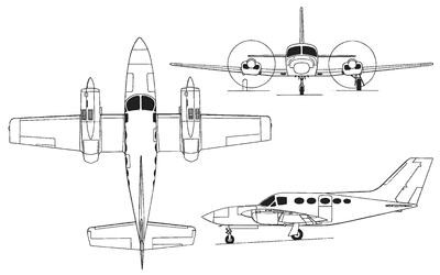
Aircraft: CESSNA 421C, registration: N700EM
Injuries: 2 Fatal.
This is preliminary information, subject to change, and may contain errors. Any errors in this report will be corrected when the final report has been completed. NTSB investigators either traveled in support of this investigation or conducted a significant amount of investigative work without any travel, and used data obtained from various sources to prepare this aircraft accident report.
On November 10, 2012, about 1920 Pacific standard time, a Cessna 421C, N700EM, impacted terrain following an in-flight breakup near Shaver Lake, California. The private pilot was operating the airplane under the provisions of 14 Code of Federal Regulations (CFR) Part 91. The pilot and passenger sustained fatal injuries. The airplane sustained substantial damaged during the accident sequence, and was partially consumed by post impact fire. The cross-country flight departed Salinas Municipal Airport, Salinas, California, about 1835, with a planned destination of Eppley Airfield, Omaha, Nebraska. Visual meteorological conditions prevailed, and an instrument flight rules (IFR) flight plan had been filed.
Preliminary radar and voice communication data provided by the FAA revealed the airplane departing Salinas on a heading of 060 degrees magnetic towards the Clovis VOR (very high frequency omni-directional radio range). The airplane reached Clovis coincident to attaining its stated cruise altitude of 27,000 feet, and the pilot reported to air traffic control personnel that he had leveled off. The controller responded, and the target began a 15-degree turn to the left. For the next 5 minutes, the airplane continued at the same altitude and heading, with no further transmissions from the pilot. The airplane then began a descending turn to the right, with a final radar target recorded 60 seconds later. During that period, it descended to 22,600 feet, with an accompanying increase in ground speed from 190 to 350 knots. For the following 6 minutes, a 5-mile-long cluster of primary targets (no altitude information) was observed emanating from the airplane's last location, on a heading of about 150
degrees.

The town of Shaver Lake is located on the western foothills of the Sierra Nevada Mountain Range, within the confines of the Sierra National Forest, at an elevation of about 5,600 feet. The main wreckage, which consisted of the cabin, inboard wings, both engines, tailcone, and vertical stabilizer, came to rest upside down on a heading of 125 degrees within a rocky outcropping, located about 1-mile southeast of the town.
The site was at an elevation of about 5,700 feet, and surrounded by trees ranging in height from 50 to 150 feet; none of the trees sustained damage. The entire lower portion of the main cabin was consumed by fire from the forward through to the rear bulkhead. The inboard right wing and engine nacelle sustained vertical crush damage, and remained partially attached to the cabin. The left inboard wing was partially consumed by fire, and along with the left engine nacelle, sustained similar crush damage.
The debris field continued on a bearing of about 150 degrees. The left and right wing, outboard of the engine nacelle, were located 2,500 and 3,200 feet, respectively, from the main wreckage. The right elevator tip and left horizontal stabilizer aft spar were located 1,000 and 1,700 feet further downrange.
 Unfortunate... ANN/SportPlane Resource Guide Adds To Cautionary Advisories

