CAP’s Middle East Region Assessing Matthew Aftermath | Aero-News Network
Aero-News Network
RSS icon RSS feed
podcast icon MP3 podcast
Subscribe Aero-News e-mail Newsletter Subscribe

Airborne Unlimited -- Most Recent Daily Episodes

Episode Date

Airborne-Monday

Airborne-Tuesday

Airborne-Wednesday Airborne-Thursday

Airborne-Friday

Airborne On YouTube

Airborne-Unlimited-04.29.24

Airborne-Unlimited-04.23.24

Airborne-Unlimited-04.24.24 Airborne-FltTraining-04.25.24

Airborne-Unlimited-04.26.24

Tue, Oct 18, 2016

CAP’s Middle East Region Assessing Matthew Aftermath

Florida, Georgia Wings Return To Normal Operations

The Civil Air Patrol Middle East Region wings have spent nearly two weeks serving their communities during the approach and aftermath of Hurricane Matthew.

Aircrews in North Carolina and South Carolina continue flying impact assessment and aerial imagery sorties.

Since Oct. 8, more than 337 members of Middle East Region wings have flown a total of 218 sorties for 276 flight hours over the Carolinas, taking photographs and relaying the information and images to the Federal Emergency Management Agency, as well as to state agencies. Aerial photographers have uploaded nearly 6,500 high-resolution, georeferenced images of rivers, towns, infrastructure and flooded areas.

“Hurricane Matthew is a mission that has reached across the entire Middle East Region,” said Col. John Knowles, the region's commander. “From several of our most senior operations staff serving at FEMA’s NRCC (National Response Coordination Center) to ground team members handing out water and basic supplies at PODS (Points of Distribution), the entire region has jumped in to help.”

The North Carolina Wing continues to fly aerial surveillance sorties over rivers and flooded areas as well as providing PODS support and transport flights for water samples. The mission is expected to continue at least through the weekend.

The Maryland, Virginia and National Capital wings provided aircrews and aircraft to the support missions in the region.

As the missions in the Carolinas wind down, the Florida and Georgia wings have returned to normal operations.

Following 12 days on activation status, the Florida Wing is “in the demobilization phase, where we reposition our aircraft, vehicles and equipment to their home bases,” said Col. Henry Irizzary, wing commander.

The wing flew a total of 47 sorties and  72 mission hours to provide FEMA with more than 18,000 damage assessment images.

“I'm extremely proud of the professionalism and dedication all our volunteers exhibited during this hurricane response. It is a true portrayal of the great members we have,” Irizarry said.

The Georgia Wing has completed its support of FEMA and the Georgia Emergency Management Agency, unless additional requests for assistance are received.

Georgia Wing aircrews flew a total of 37 sorties for aerial photo reconnaissance of affected Georgia coastal areas, totaling more than 90 flight hours. The wing provided more than 18,000 photographs to FEMA and GEMA, which allowed those agencies to create a photographic mosaic of affected areas and rapidly assess damage wrought by the hurricane. 

More than 65 pilots, aircrew, communicators and mission staff responded in Georgia.

All of the above missions have been conducted with the approval of 1st Air Force (Air Forces Northern), the designated air component of USNORTHCOM. When tasked, it conducts Defense Support of Civil Authorities operations within the USNORTHCOM area of responsibility and assists in providing advice, liaison and oversight to CAP as the U.S. Air Force Auxiliary when tasked for emergency services and disaster relief operations.

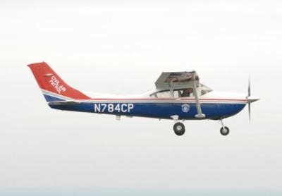
(Source: CAP news release. Image from file)

FMI: www.gocivilairpatrol.com

Advertisement

More News

Unfortunate... ANN/SportPlane Resource Guide Adds To Cautionary Advisories

The Industry Continues to be Rocked By Some Questionable Operations Recent investigations and a great deal of data has resulted in ANN’s SportPlane Resource Guide’s rep>[...]

ANN FAQ: Turn On Post Notifications

Make Sure You NEVER Miss A New Story From Aero-News Network Do you ever feel like you never see posts from a certain person or page on Facebook or Instagram? Here’s how you c>[...]

ANN's Daily Aero-Term (04.29.24): Visual Approach Slope Indicator (VASI)

Visual Approach Slope Indicator (VASI) An airport lighting facility providing vertical visual approach slope guidance to aircraft during approach to landing by radiating a directio>[...]

ANN's Daily Aero-Term (04.28.24): Airport Marking Aids

Airport Marking Aids Markings used on runway and taxiway surfaces to identify a specific runway, a runway threshold, a centerline, a hold line, etc. A runway should be marked in ac>[...]

ANN's Daily Aero-Linx (04.28.24)

Aero Linx: The Skyhawk Association The Skyhawk Association is a non-profit organization founded by former Skyhawk Pilots which is open to anyone with an affinity for the A-4 Skyhaw>[...]

blog comments powered by Disqus


Advertisement

Advertisement

Podcasts

Advertisement

© 2007 - 2024 Web Development & Design by Pauli Systems, LC