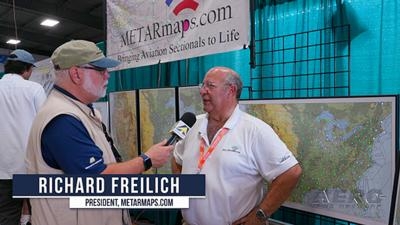
Developed by pilot, aircraft-owner, and entrepreneur Richard Freilich, METARmaps are syncretisms of visual art and real-time meteorological observations manifested in unique and useful wall decoration.
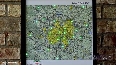
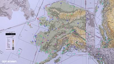
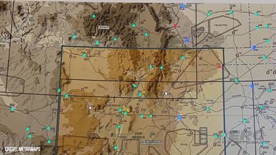
METARmaps consist of meticulous recreations of VFR Sectional charts—or sections, composites, or collections thereof—imbued with tiny processors controlling the illumination and color of LED lights representing METAR-reporting airports within the chart’s geographical boundaries. Subject LEDs depict generalized, real-time weather conditions prevailing at the airports represented thereby.
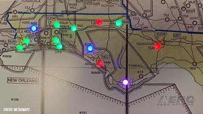
Consistent with the FAA’s chromatic weather depiction scheme, METARmaps LEDs shone green indicate VFR weather conditions. Marginal VFR conditions are represented by blue LEDs. Conversely, IFR and Low-IFR weather conditions are denoted by red and purple LEDs respectively. Flashing LEDs, regardless of color, indicate high winds.
Buyers may add their home airports (singular) free of charge. Additional custom airports may be added to METARmaps for $25-apiece.
Among the more popular METARmaps is a 36" (wide) x 24" (high) x 1" (deep) depiction of the contiguous United States. The matte-black-framed, poly-glazed, Medium Density Fiberboard (MDF) objed d’art features nearly 250 LEDs, each representing a METAR reporting airport.
By dint of a mobile-telephone (no app required), METARmaps owners can customize display parameters the likes of update-rate, wind, wind-gust, and lightning depictions.
To function, METARmaps require 2.4 GHZ Wi-Fi Internet access, AC power, and a suitable surface upon which to hang. It should be noted that only METAR-reporting airports with runways four-thousand-feet or longer are represented on METARmaps.
To the subject of his creations, Mr. Freilich stated: “METARmaps have been embraced across all sectors: general aviation pilots, commercial aviation, Fixed Base Operators (FBO’s), Avidyne, ForeFlight, including Air Traffic Controllers, meteorologists, and others.”
Smaller METARmaps depicting Terminal Area Charts have also proved popular. Currently, no fewer than forty terminal areas—from Atlanta and Austin to Memphis and Miami to Toronto and Vancouver—are available.
Pricing for METARmaps ranges from approximately $200 for terminal areas to $475-$685 for individual U.S. states and geographical regions to as much as $1,899 for a sprawling triptych of the contiguous United States. The latter features nearly six-hundred airports distributed across three panels, each measuring 36” (high) x 20” (wide).
All METARmaps are built to order in the United States. Every unit undergoes an extensive testing process and compulsory burn-in process. Ergo, buyers should expect to take possession of their METARmaps four-to-six weeks after ordering such.
Aero-TV is a production of the Internationally syndicated Aero-News Network. Seen worldwide by hundreds of thousands of aviators and aviation adherents, ANN's Aero-TV has produced over 5000 aviation and feature programs, including nearly 2000 episodes of our daily aviation news program, AIRBORNE UNLIMITED, currently hosted by Holland Lee. Now in its third decade of operation, parent company Aero-News Network, has the most aggressive and intensive editorial profile of any aviation news organization and has published nearly a half-million news and feature stories since its inception -- having pioneered the online 24/7 aviation new-media model that so many have emulated.
DETRESFA (Distress Phrase) The code word used to designate an emergency phase wherein there is reasonable certainty that an aircraft and its occupants are threatened by grave and i>[...]
Aero Linx: The International Association of Missionary Aviation (IAMA) The International Association of Missionary Aviation (IAMA) is comprised of Mission organizations, flight sch>[...]
Also: EP Systems' Battery, Boeing SAF, Repeat TBM 960 Order, Japan Coast Guard H225 Buy Despite nearly 100 complaints totaling millions of dollars of potential fraud, combined with>[...]
Also: Viasat-uAvionix, UL94 Fuel Investigation, AF Materiel Command, NTSB Safety Alert Norges Luftsportforbund chose Aura Aero's little 2-seater in electric trim for their next gli>[...]
Also: Moya Delivery Drone, USMC Drone Pilot, Inversion RAY Reentry Vehicle, RapidFlight UAVOS has recently achieved a significant milestone in public safety and emergency services >[...]
 ANN's Daily Aero-Term (04.26.24): DETRESFA (Distress Phrase)

