Thu, Feb 03, 2011
FCC Grants Licence For 40,000 Watt Transmitters On Adjacent
Frequencies
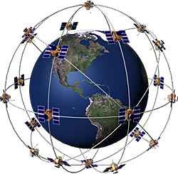
 The FCC has granted a license to a company called
LightSquared, which plans to offer 4G wireless broadband services
nationwide. But studies show the service may severely
interfere with GPS navigation, according to one GPS industry
source.
The FCC has granted a license to a company called
LightSquared, which plans to offer 4G wireless broadband services
nationwide. But studies show the service may severely
interfere with GPS navigation, according to one GPS industry
source.
A report on the GPS World website indicated that the GPS
industry offered data to the FCC showing that LightSquared's
operations could cause GPS receivers to "cease to operate" in areas
near the the 40,000 watt transmitters the company plans to erect.
GPS manufacturers Garmin and Trimble both contributed to the report
"Experimental Evidence Of Wide Area GPS Jamming" which was
presented to the FCC.
The manufacturers found that a Garmin GNS 430W lost its fix in
open sky more than five statute miles from one of the transmitters,
and interference was detected at nearly 14 SM. The testing was
conducted using simulated GPS signals representing a constellation
of 31 satellites, and the Lightsquared transmission was simulated
to actual technical specifications, according to the report.
The FCC decided to waive its own rules and permit Lightsquared
to broadcast in the L Band despite potential interference. In its
final ruling, the FCC does admit that interference with GPS is a
"significant concern," and that the interference issues "must be
addressed" before LightSquared could light up its wireless network.
But since the interference would stem from transmissions in the
authorized spectrum, rather than the GPS band, the FCC "expects the
GPS industry to work expeditiously and in good faith with
LightSquared to ameliorate the interference concerns."
Lightsquared has said it will "work with the GPS industry" to
determine which GPS receivers would require "filtering so that they
don't look into our band." There is no mention as to what those
filters might entail, or at what cost to those who own the
equipment.
LightSquared hopes to have its 4G wireless network up and
operating by June 15th of this year.
More News
Airport Marking Aids Markings used on runway and taxiway surfaces to identify a specific runway, a runway threshold, a centerline, a hold line, etc. A runway should be marked in ac>[...]
"It is extremely difficult, if not impossible, for manned aircraft to see a drone while conducting crop-enhancing and other aerial applications at low altitudes and high speeds. We>[...]
Aero Linx: The Skyhawk Association The Skyhawk Association is a non-profit organization founded by former Skyhawk Pilots which is open to anyone with an affinity for the A-4 Skyhaw>[...]
“The T-54A benefits from an active Beechcraft King Air assembly line in Wichita, Kansas, where all required METS avionics and interior modifications are installed on the line>[...]
Aero Linx: Aerostar Owners Association The Association offers the Aerostar Owner a unique opportunity to tap an invaluable source of information concerning the care and feeding of >[...]
 ANN's Daily Aero-Term (04.28.24): Airport Marking Aids

