Mon, Mar 16, 2020
Value Could Reach $11 Billion By 2023
The global drone services market and the market is poised to experience spend growth of more than $11 billion between 2018-2023 at a Compound Annual Growth Rate (CAGR) of over 50% during the forecast period, according to a new report from Send Edge.
An exponentially rising demand for rotary-wing drones for support search and rescue operations is acting as the primary factor driving this double-digit spend growth in the global drone services market. Drone services are experiencing an extensive adoption in the infrastructure industry for aerial mapping of properties to collect data and photographs of the same. However, factors such as the availability of alternate solutions that have better flight endurance and concerns over privacy and safety are limiting the sales in the drone services market.
The growing shortage of skilled pilots and the requirement to invest more in training and development programs are majorly accelerating OPEX of service providers in the drone services market. This, in turn, is inflating procurement expenses incurred by buyers in this market. On this note, this report has listed the top drone service providers, SLA agreement insights, and the selection and negotiation strategies that buyers must undertake to achieve optimal and cost-effective procurement in this market.
Cyberhawk Innovations - Susceptibility to technical faults or wear and tear can result in the stoppage of a drone operation mid-air. This is a serious threat to buyers' assets as drones can damage components belonging to buyers. Considering this probability, it is imperative for buyers to ensure that this drone service provider offers liability insurance to ensure monetary coverage for buyers.
Delair SAS - Buyers are advised to determine the capability of this service provider to optimize flight routes and trajectory. This will reduce the time taken to map the required area while eliminating the number of times batteries need to be swapped to continue the drone operation. Ideally, service providers should fly the drone at 250-300 feet to create most of the maps. In this range, the resolution is high, and the image-stitching and processing time will be less. But for large projects, such as forestry, drones should fly at a higher altitude of about 400 feet for optimal imagery mapping.
Sharper Shape - Buyers should ensure that this service provider leverages industry-standard tools such as Autodesk used in the construction industry or ArcGIS used in the agriculture industry in which the captured data can be exported. This can help buyers extract actionable insights by making use of powerful tools and combining the information with other datasets.
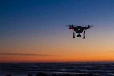
(Source: Spend Edge news release. Image from file)
More News
Hazardous Weather Information Summary of significant meteorological information (SIGMET/WS), convective significant meteorological information (convective SIGMET/WST), urgent pilot>[...]
Aero Linx: The T-6 Racing Association The T-6 Racing Association is all about T-6‘s and racing. Our mission is to bring great racing to our fans in Reno and other venues wher>[...]
Also: Electra Aero, AMO-CBP v Smugglers, Naval King Airs, Boeing Deal To the surprise of everyone involved, Waco Kitchen shut down both airport operations with little warning and h>[...]
Also: WACO Kitchen Bails, French SportPlane Mfr to FL, Dynon-Advance Flight Systems, Innovation Preview Bobby Bailey, a bit of a fixture in sport aviation circles for his work with>[...]
Also: Virgin Galactic, B-29 Doc to Allentown, Erickson Fire-Fighters Bought, FAA Reauthorization After dealing with a big letdown after the unexpected decision by Skyreach to disco>[...]
 ANN's Daily Aero-Term (05.07.24): Hazardous Weather Information

