FAA Launches National Capital Region No Drone Zone Campaign | Aero-News Network
Aero-News Network
RSS icon RSS feed
podcast icon MP3 podcast
Subscribe Aero-News e-mail Newsletter Subscribe

Airborne Unlimited -- Most Recent Daily Episodes

Episode Date

Airborne-Monday

Airborne-Tuesday

Airborne-Wednesday Airborne-Thursday

Airborne-Friday

Airborne On YouTube

Airborne-Unlimited-04.29.24

Airborne-Unlimited-04.23.24

Airborne-Unlimited-04.24.24 Airborne-FltTraining-04.25.24

Airborne-Unlimited-04.26.24

Thu, May 14, 2015

FAA Launches National Capital Region No Drone Zone Campaign

Aim Is To Educate The Public About The Prohibition Against UAV Flights In D.C., Near National Airport

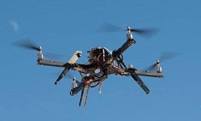
The FAA has announced a public outreach campaign for the National Capital Region around Washington, D.C. to reinforce the message that the District of Columbia and cities and towns within a 15-mile radius of Ronald-Reagan Washington National Airport are a No Drone Zone.

“Federal rules prohibit any aircraft from operating in the Flight Restricted Zone around our nation’s capital without specific approval,” said U.S. Transportation Secretary Anthony Foxx. “That includes all unmanned aircraft.”

The FAA is making outreach materials available to other federal, state and local partners around the National Capital Region to ensure that residents and tourists all understand that operating an unmanned aircraft in this area for any purpose is against the law.

The airspace around Washington, D.C. is more restricted than in any other part of the country. Rules put in place after the 9/11 attacks establish “national defense airspace” over the area and limit aircraft operations to those with an FAA and Transportation Security Administration authorization. Violators face stiff fines and criminal penalties.

“Anyone visiting the DC area should leave their drone at home,” said FAA Administrator Michael Huerta. “We want to make sure everyone knows and understands the rules about flying in the National Capital Region.”

As part of its public education efforts, the FAA is developing a GPS-driven smartphone app to tell recreational unmanned aircraft operators where they can and cannot legally operate. The FAA expects to release the app for Apple devices later this year after beta testing is complete.

FMI: www.faa.gov

Advertisement

More News

Unfortunate... ANN/SportPlane Resource Guide Adds To Cautionary Advisories

The Industry Continues to be Rocked By Some Questionable Operations Recent investigations and a great deal of data has resulted in ANN’s SportPlane Resource Guide’s rep>[...]

ANN FAQ: Turn On Post Notifications

Make Sure You NEVER Miss A New Story From Aero-News Network Do you ever feel like you never see posts from a certain person or page on Facebook or Instagram? Here’s how you c>[...]

ANN's Daily Aero-Term (04.29.24): Visual Approach Slope Indicator (VASI)

Visual Approach Slope Indicator (VASI) An airport lighting facility providing vertical visual approach slope guidance to aircraft during approach to landing by radiating a directio>[...]

ANN's Daily Aero-Term (04.28.24): Airport Marking Aids

Airport Marking Aids Markings used on runway and taxiway surfaces to identify a specific runway, a runway threshold, a centerline, a hold line, etc. A runway should be marked in ac>[...]

ANN's Daily Aero-Linx (04.28.24)

Aero Linx: The Skyhawk Association The Skyhawk Association is a non-profit organization founded by former Skyhawk Pilots which is open to anyone with an affinity for the A-4 Skyhaw>[...]

blog comments powered by Disqus


Advertisement

Advertisement

Podcasts

Advertisement

© 2007 - 2024 Web Development & Design by Pauli Systems, LC