Mars Rover 2.0? | Aero-News Network
Aero-News Network
RSS icon RSS feed
podcast icon MP3 podcast
Subscribe Aero-News e-mail Newsletter Subscribe

Airborne Unlimited -- Most Recent Daily Episodes

Episode Date

Airborne-Monday

Airborne-Tuesday

Airborne-Wednesday Airborne-Thursday

Airborne-Friday

Airborne On YouTube

Airborne-Unlimited-05.13.24

Airborne-NextGen-05.07.24

Airborne-Unlimited-05.08.24 Airborne-FlightTraining-05.09.24

Airborne-Unlimited-05.10.24

Wed, May 19, 2004

Mars Rover 2.0?

Israeli Scientists Pioneer Efforts To Make Future Mars Rovers Self-Navigating

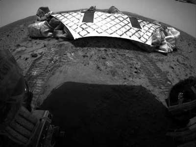
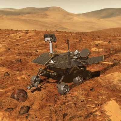
There was a time when we wondered how much fun it would be to remote-pilot one of the Mars rovers across the surface of the Red Planet.

That lasted about five minutes.

Consider: The pilots of Spirit and Opportunity must very carefully figure out where they want to go, assess the risks and painstakingly plot a course. Then they have to hope that nothing will come in the rover's way and that there are no unexpected terrain features because it takes several minutes for the driver's instructions to reach the vehicle itself, given the distance and those bothersome equations from Einstein regarding the speed of light. And then there's the fact that you just can't get driver's insurance on Mars...

But a team of Israeli scientists working with NASA hopes to change all that. The idea is to develop software that would allow the rovers, for the most part, to get where they're going on their own.

"You'll be able to leave the rover alone for two days and not come back to find that it fell into a crater," said Professor Zvi Shiller, from the College of Judea and Samaria (CJS), who is heading the three-year project.

But, Schiller warns, a self-guided rover "is based on the rather strong assumption we get a good digital map of the area of the robot," and scientists do not yet have all the data necessary to build such maps.

That could be changing, however, with satellites now in orbit around Mars, taking detailed photos to map the surface. Nothing in Shiller's world is more important.

"You need to know the topography, the geography of the surface, the consistency of the ground," he said. "Is it sand? Is it rock? Using this information we can calculate 'good paths' that are fast, short and take into account descent, tip over, slide."

Shiller's goal, however, seems hampered by politics endemic to the Middle East. Left-wing Jewish activists have bombarded the US government and NASA, demanding that the project not be funded with American dollars.

It's not.

The Israeli Ministry of Science, through the Israel Space Agency, is "the only government agency actually supporting us," he said. Funding for the project's recently completed first year was a modest $32,600.

Still, the Israeli-American scientist says his group at the university will plod on in its research. "We definitely suffer from a very limited budget," he said, "but I think we will eventually come up with a good product. It just means lots and lots of hours."

FMI: www.yosh.ac.il

Advertisement

More News

Sierra Space Repositions Dream Chaser for First Mission

With Testing Soon Complete, Launch Preparations Begin in Earnest Sierra Space's Dream Chaser has been put through the wringer at NASA's Glenn Armstrong Test Facility in Ohio, but w>[...]

ANN's Daily Aero-Term (05.10.24): Takeoff Roll

Takeoff Roll The process whereby an aircraft is aligned with the runway centerline and the aircraft is moving with the intent to take off. For helicopters, this pertains to the act>[...]

Aero-News: Quote of the Day (05.10.24)

“We’re proud of the hard work that went into receiving this validation, and it will be a welcome relief to our customers in the European Union. We couldn’t be mor>[...]

Aero-News: Quote of the Day (05.11.24)

"Aircraft Spruce is pleased to announce the acquisition of the parts distribution operations of Wag-Aero. Wag-Aero was founded in the 1960’s by Dick and Bobbie Wagner in the >[...]

ANN's Daily Aero-Term (05.11.24): IDENT Feature

IDENT Feature The special feature in the Air Traffic Control Radar Beacon System (ATCRBS) equipment. It is used to immediately distinguish one displayed beacon target from other be>[...]

blog comments powered by Disqus


Advertisement

Advertisement

Podcasts

Advertisement

© 2007 - 2024 Web Development & Design by Pauli Systems, LC