Mission Control Designates First Martian 'National Park'
Scientists leading NASA's Phoenix Mars mission from the
University of Arizona in Tucson sent commands to unstow its robotic
arm and take more images of its landing site early Wednesday.
The Phoenix lander sent back new sharp color images from Mars
late Tuesday. Phoenix imaging scientists made a color mosaic of
images taken by the lander's Surface Stereo Imager on landing day,
May 25, and the first two full "sols," or Martian days, after
landing.
The panorama, now about one-third complete, shows a fish-eye
perspective from the camera, a view from the lander itself all the
way to the horizon. Phoenix adjusts its color vision with
"Caltargets," calibrated color targets on disks mounted on the
landing deck. Its color vision isn't quite like human color vision,
but close.
"These images are very exciting to the science team," said the
Surface Stereo Imager co-investigator Mark Lemmon of Texas A&M
University. "We see the polygons we're looking for, and we're very
excited to fill in the context with more site pan images that go
beyond the workspace." Images to complete the panorama are planned
today and tomorrow, Sols 3 and 4, Lemmon said.
"We appear to have landed where we have access to digging down a
polygon trough the long way, digging across the trough, and digging
into the center of a polygon. We've dedicated this polygon as the
first national park system on Mars -- a "keep out" zone until we
figure out how best to use this natural Martian resource," Lemmon
said.
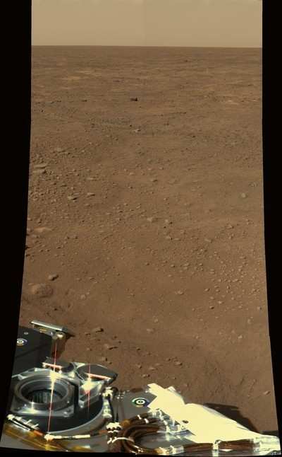
Phoenix will use its robotic arm to dig first in another area
seen in the panorama, an area outside the preserved polygon.
Robotic arm manager Bob Bonitz of NASA's Jet Propulsion
Laboratory, Pasadena, CA, explained how the arm was to be unstowed.
"It's a series of seven moves, beginning with rotating the wrist to
release the forearm from its launch restraint. Another series of
moves releases the elbow from its launch restraints and moves the
elbow from underneath the biobarrier."
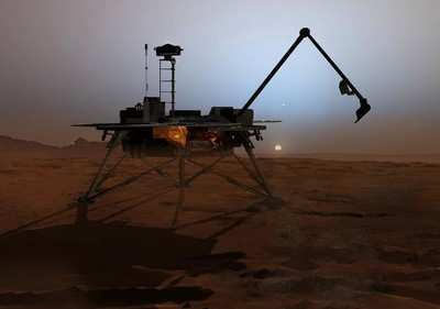
The robotic arm is a critical part of the Phoenix Mars mission.
It is needed to trench into the icy layers of northern polar Mars
and deliver samples to instruments that will analyze what Mars is
made of, what its water is like, and whether it is or has ever been
a possible habitat for life.
"Phoenix is in perfect health," JPL's Barry Goldstein, Phoenix
project manager, said Wednesday morning, May 28.
As ANN reported, the robotic
arm's first movement was delayed by one day when Tuesday's commands
from Earth did not get all the way to the Phoenix lander on Mars.
The commands went to NASA's Mars Reconnaissance Orbiter as planned,
but the orbiter's Electra UHF radio system for relaying commands to
Phoenix temporarily shut off. Without new commands, the lander
instead carried out a set of activity commands sent Monday as a
backup. Images and other information from those activities were
successfully relayed back to Earth by the Mars Reconnaissance
Orbiter Tuesday evening.

Wednesday morning's uplink to Phoenix and evening downlink from
Phoenix were planned with NASA's Mars Odyssey orbiter as the relay.
"We are using Odyssey as our primary link until we have a better
understanding of what happened with Electra," Goldstein said.
 ANN's Daily Aero-Term (04.25.24): Airport Rotating Beacon

