Thu, Jul 16, 2015
Aircraft Spotted Flying Over Mill 2 Fire In Southern California
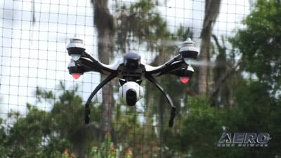
A small UAV has reportedly once again gotten in the way of firefighting efforts in Southern California, this time grounding tankers working to contain the Mill 2 fire near Yucaipa in the San Bernardino National Forest.
U.S. Forest Service San Bernardino National Forest spokesperson Carol Underhill said that "as drones become more popular, this is becoming an issue."
According to the Forest Service, The Mill 2 Fire was reported at 2:38 pm Sunday in Mill Creek Canyon near State Highway 38 above Bryant Street in Yucaipa and burned 35 acres of steep chaparral covered slopes.
State Highway 38 was closed earlier, however it was re-opened at 6:00 pm. Four homes on the lower or west end of Yucaipa Ridge were evacuated by the San Bernardino County Sheriff. The cause of the fire is under investigation and the fire is now ten percent contained.
The Mill 2 Fire is being managed in unified command US Forest Service and CALFIRE. Resources that responded included: 17 engines, 7 crews, 2 dozers, 5 helicopters, 2 fixed wing air tankers, and one air attack plane.
An Unmanned Aircraft System (drone) temporarily halted tanker operations, but operations soon resumed. Fire Managers urge individuals and organizations that fly drones to avoid the wildfire areas to ensure the safety of firefighters and the effectiveness of wildfire suppression operations. Unauthorized drone flights over or near the wildfires could cause serious injury or death to firefighters on the ground. Unauthorized drones could also be involved in midair collisions with airtankers, helicopters, and other aircraft engaged in fire suppression operations. This could decrease the effectiveness of fire suppression operations, allowing the fire to grow larger and potentially threaten lives, property, and valuable natural and cultural resources.
Firefighting aircraft typically fly at about the same, or lower, altitude than hobbyists or recreationists fly drones, often in smoky, windy, and turbulent conditions. Safety depends on knowing what other aircraft are operating in the airspace and where they are at all times and this is compromised by the presence of unauthorized aircraft, including drones.
(Image from file)
More News
Airport Marking Aids Markings used on runway and taxiway surfaces to identify a specific runway, a runway threshold, a centerline, a hold line, etc. A runway should be marked in ac>[...]
"It is extremely difficult, if not impossible, for manned aircraft to see a drone while conducting crop-enhancing and other aerial applications at low altitudes and high speeds. We>[...]
Aero Linx: The Skyhawk Association The Skyhawk Association is a non-profit organization founded by former Skyhawk Pilots which is open to anyone with an affinity for the A-4 Skyhaw>[...]
“The T-54A benefits from an active Beechcraft King Air assembly line in Wichita, Kansas, where all required METS avionics and interior modifications are installed on the line>[...]
Aero Linx: Aerostar Owners Association The Association offers the Aerostar Owner a unique opportunity to tap an invaluable source of information concerning the care and feeding of >[...]
 ANN's Daily Aero-Term (04.28.24): Airport Marking Aids

