Tue, Feb 28, 2017
Aircraft Built For Enterprise Solutions
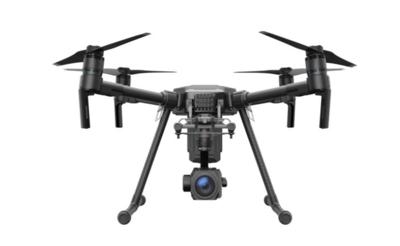
DJI has unveiled the new Matrice 200 drone series (M200), which is purpose-built for professional users to perform aerial inspections and collect data – making drone technology an affordable and easy-to-use tool for enterprises that recognize how aerial imaging can transform their operations.
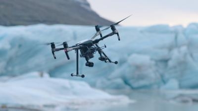
The M200 series’ folding body is easy to carry and easy to set up, with a weather- and water-resistant body, ideal for field operations. It offers DJI’s first upward-facing gimbal mount, opening up the undersides of bridges, towers and other structures to inspection. It is compatible with DJI’s powerful X4S and X5S cameras, as well as the high-powered Z30 zoom camera and the XT camera for thermal imaging. It has a forward-facing first-person view camera, allowing a pilot and a camera operator to monitor separate images on dual controllers. Its safety features include obstacle avoidance sensors facing forward, up and down, as well as an ADS-B receiver for advisory traffic information from nearby manned aircraft. With a dual battery set-up, the M200 platform can fly for up to 35 minutes with a mounted camera.
“Drones have quickly become a standard part of the enterprise toolkit and industrial users have come to rely on DJI technology to efficiently collect aerial data,” said Paul Guo, Director Enterprise Solutions at DJI. “With the M200 series, DJI introduces a holistic solution designed specifically for these users. We are revolutionizing professional workflows by making it possible to use advanced sensors in various combinations to make sophisticated tasks such as bridge inspections, land surveying and search-and-rescue missions, easier, safer and more reliable than ever before.”
The M200 series is designed for professionals using drones for more precise, efficient and safe aerial data collection. Examples of industry applications include:
- Critical Infrastructure Inspections – work near power lines, telecommunications towers and bridges puts inspectors at risk of falls and electric shock. DJI’s M200 improves safety as work can be done from a distance. The M200 can identify millimeter-sized faults in buildings, roads and bridges in real time, making those operations more safe, efficient and effective.
- Energy Facility Inspections – maintenance planning can be costly and time-consuming. With the stable and weather-resistant M200 platform, extensive power line networks can be visualized with unparalleled detail and vertical infrastructure, such as wind turbines and offshore oil rigs, can be inspected from all angles.
- Construction Site Mapping – surveying and mapping often need to be conducted regardless of weather conditions and other external factors. The M200 is a rugged platform designed to handle tough conditions. The M200 gives construction site managers an efficient tool to review progress and workflow, ensuring more efficient use of resources.
- Public Safety – when time is of essence and weather conditions turn foul, first responders require a versatile and reliable aerial platform. Carrying visual and/or thermal sensors, the M200 provides situational awareness of potentially dangerous situations such as fires, searches and natural disasters. Incident commanders can use data collected by the M200 to make smarter and better decisions, protecting life and property while minimizing the safety risk to rescue personnel.
(Images provided with DJI news release)
More News
Airport Rotating Beacon A visual NAVAID operated at many airports. At civil airports, alternating white and green flashes indicate the location of the airport. At military airports>[...]
Aero Linx: Fly for the Culture Fly For the Culture, Inc. is a 501(c)(3) non-profit organization that serves young people interested in pursuing professions in the aviation industry>[...]
Klyde Is Having Some Issues Comprehending The Fed's Priorities FMI: www.klydemorris.com>[...]
Also: Viasat-uAvionix, UL94 Fuel Investigation, AF Materiel Command, NTSB Safety Alert Norges Luftsportforbund chose Aura Aero's little 2-seater in electric trim for their next gli>[...]
Also: EP Systems' Battery, Boeing SAF, Repeat TBM 960 Order, Japan Coast Guard H225 Buy Despite nearly 100 complaints totaling millions of dollars of potential fraud, combined with>[...]
 ANN's Daily Aero-Term (04.25.24): Airport Rotating Beacon

