Will Provide UTM Services To Advance High-Scale Commercial Drone Operations Across The United States
The U.S. Department of Transportation and the FAA have announced the state, local, and tribal governments approved to enable complex drone operations in 10 locations, and AirMap is included in six of them. The announcement comes as part of the U.S. DOT's UAS Integration Pilot Program (IPP), designed to accelerate the integration of drones into the national airspace through public-private partnerships.
AirMap technology will enable each of the state, local, and tribal governments ("lead applicants") to open their skies for complex commercial drone operations, such as flights for package delivery, medical transport, search and rescue, emergency response and recovery, public safety, journalism, inspections and surveying, and more.
The IPP clears the way for commercial drone activity that is currently prohibited due to a lack of supporting infrastructure in place to solve for complexity in low-altitude airspace. "Drones are a transformative technology and for them to truly become a part of everyday life the industry must work with state and local stakeholders who work and live where these drones will operate," said Greg McNeal, AirMap co-founder. "The genius of the IPP is that it relies on collaboration to open the skies, harmonizing the way society balances the concerns of some communities with our desire to quickly achieve the full promise of drone technology."
As the leading global provider of UAS Traffic Management (UTM) for drone operations, AirMap is the named UAS Service Supplier (USS) in the following six winning applications:
- North Carolina Department of Transportation (NCDOT) - The North Carolina application, led by the Department of Transportation, showcases UAS package delivery. Flytrex, Mattenet, and Zipline will work with AirMap to deconflict package delivery operations in the Raleigh-Durham area.
- Kansas Department of Transportation (KDOT) - The Kansas application, led by the Department of Transportation, involves a diversity of use cases, including package delivery, disaster response, agricultural surveying, and short line and nuclear power plant inspection. Kansas plans to test operations BVLOS, at night, and over human beings. Previously, Kansas was the first state in the nation to roll-out statewide UTM services, through a partnership with AirMap.
- City of Reno - The City of Reno, with support from Reno Police Department and Reno Fire Department, has partnered with Flirtey, Regional Emergency Medical Services Authority (REMSA), The City of Sparks, Washoe County, AirMap, an area tribal government, commercial partners including startups and other not-for-profit organizations to showcase package delivery operations in the airspace around the city.
- Choctaw Nation of Oklahoma - The Choctaw Nation is a tribal nation in Oklahoma. The Choctaw Nation application involves testing of the weather effects on drones, package delivery, herd management, utility and infrastructure inspection, public safety cases, and development of UTM. AirMap will be providing UTM services to enable UAS operations.
- North Dakota Department of Transportation - The North Dakota application, led by the North Dakota Department of Transportation, will enable a variety of private and public sector uses for UAS. AirMap will provide UTM services to enable these operations and encourage the adoption of UAS across the state.
- City of San Diego - The San Diego application, led by the City of San Diego, will explore complex operations in public safety, package delivery, medical delivery, international commerce and border security, and smart cities/autonomous vehicles. AirMap will work with Matternet and UCSD Health for autonomous drone delivery of patient blood and pathology specimens. AirMap will be working directly with Qualcomm who will be testing cellular connectivity in each of the city's operations.
"The FAA gave the green light today to open up parts of the airspace to operations that have previously been prohibited," McNeal said. "We are proud to be partnering with each of these states, cities and tribal nations to kickstart their local drone economy."
This announcement is only the beginning for the UAS IPP program. Over the next two and a half years, the FAA is expected to carefully determine how state and local government's can create a welcoming environment for cutting-edge commercial drone operations. The operations conducted with the support of AirMap will inform a future rulemaking process.
Scheduled to run at least through late 2020, the White House and FAA have indicated that the UAS IPP may give them a way to fast track waivers during the course of the program. DOT has also indicated that additional applicants may be accepted to the program during the three year slated period.
"A collaborative approach bringing together industry, national authorities and local stakeholders is the fastest way to open the sky for innovation," said McNeal. "Our experiences in the U.S. and abroad have proven that we can innovate quickly when all stakeholders have a voice."
With UTM deployments in Japan, New Zealand, Switzerland, and the United States, AirMap is the most comprehensive and connected platform of its kind. The platform offers up-to-date airspace information for every country in the world, national airspace rules for more than 20 countries, and the largest network of drone operators, manufacturers, and airspace managers in the drone ecosystem, reaching more than 85% of the world's drones.
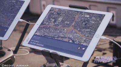
(Source: AirMap news release. Image from file)
 ANN's Daily Aero-Term (04.25.24): Airport Rotating Beacon

