Mon, Jul 23, 2012
Combines LiDAR With Hi-Res Aerial Photography
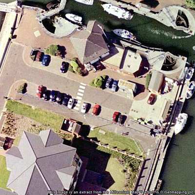
Leicestershire (UK) aerial surveying company Bluesky has purchased and airborne system that combines laser mapping with high resolution aerial photography and infrared image capture. The system allows high precision mapping of the land and cities in 3D together with aerial image capture and a thermal mapping capability to measure heat loss from buildings.

The laser mapping known as LiDAR (Light Imaging Detection and Ranging) system uses aircraft mounted lasers to accurately determine the distance between the sensor and the ground or other targets such as buildings and vegetation.
The integrated three-sensor system has been developed by Canadian company Optech. Specifically designed to offer a cost effective, high performance solution at mid altitudes, the Optech Orion M300 is ideally suited for applications such as electricity transmission network mapping, transport infrastructure modelling and environmental monitoring such as flood risk analysis and forestry management. It will also enable Bluesky to capture highly accurate 3D measurements from which to create special maps such as their UK-wide solar potential map and 3D city models.
The thermal sensor records infrared measurements and will be used for identifying heat loss from buildings and monitoring pipelines. It can be used simultaneously with the LiDAR or independently. In addition the ultra-high resolution digital camera captures images of the target sites and again can be used simultaneously with the other two sensors providing customers with a wealth of coincident information for their area of interest; a complete solution and substantial acquisition savings.
"There is an increasing demand for high tech aerial surveying as it provides a rapid way to accurately map infrastructure, floodplains and urban areas. The new technology we are bringing to the UK is the most advanced yet and will benefit our customers that include utilities, developers and government." commented Rachel Tidmarsh, Managing Director of Bluesky International. "This significant investment will give us a key advantage here and overseas, providing an important platform for business growth."
More News
“My father mastered a unique trio of skills, being an exceptionally good mechanical engineer, electrical engineer, and astute businessman. He set the bar high for himself and>[...]
Standard Terminal Arrival (STAR) Charts Designed to expedite air traffic control arrival procedures and to facilitate transition between en route and instrument approach operations>[...]
Less Than 8 Ounces Of Fuel Was Drained From The Fuel System On April 24, 2023, at 1030 eastern daylight time, an experimental amateur-built, Thatcher CX4, was substantially damaged>[...]
Aero Linx: National Air and Space Museum Take your curiosity to new heights. Explore the world’s premier collection of air and space artifacts, stories, and expertise. One mu>[...]
A Few Questions AND Answers To Help You Get MORE Out of ANN! 1) I forgot my password. How do I find it? 1) Easy... click here and give us your e-mail address--we'll send it to you >[...]
 Aero-News: Quote of the Day (06.05.24)