The View From Up Here | Aero-News Network
Aero-News Network
RSS icon RSS feed
podcast icon MP3 podcast
Subscribe Aero-News e-mail Newsletter Subscribe

Airborne Unlimited -- Most Recent Daily Episodes

Episode Date

Airborne-Monday

Airborne-Tuesday

Airborne-Wednesday Airborne-Thursday

Airborne-Friday

Airborne On YouTube

Airborne-Unlimited-10.28.24

Airborne-NextGen-10.29.24

Airborne-Unlimited-10.30.24

Airborne-Unlimited-10.24.24

Airborne-Unlimited-10.25.24

Thu, May 13, 2004

The View From Up Here

True To Life Scenery Of "The City By The Bay" For Microsoft Flight Simulator

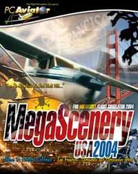
MegaScenery publisher, PC Aviator, today announced that the third volume of MegaScenery – Northern California, featuring San Francisco, Sacramento and 38,000 square miles of surrounding countryside has gone gold and is scheduled for release on 7 June 2004.

Bigger, better and prettier than previous MegaScenery areas, "MegaScenery Volume 3: Northern California" has been recreated from 5 meter satellite imagery and puts Microsoft Flight Simulator pilots up there in the skies above this diversely picturesque region of the United States.

San Francisco, Oakland, Sacramento, down to Monterey bay and inland to the W120.5 longitudinal line…. and everything else in between: Flight Simulator pilots will be able to take to the skies and navigate this expansive scenery identifying everything down to individual rooftops on houses.

Aerosoft Australia, developers of MegaScenery, have continued to enhance MegaScenery technology and this volume comes with even further improved night scenery. 

It also incorporates high-resolution 30 meter terrain mesh for elevation data resulting in even more realistic mountains and valleys.

While there are other photo-realistic scenery products available only MegaScenery provides complete night scenery for the entire area so users get both a day and night VFR flying experience.

Just like the previous titles and all future MegaScenery titles, the Northern California package comes with all of the real world aeronautical charts required to fly the scenery [like a pilot] and to identify all of the major landmarks the scenery contains.

FMI: http://www.megascenery.com

Advertisement

More News

Senator Pushes FAA to Accelerate Rocket Launch Licensing

States That Current Process is Damaging National Aerospace Development US Senator Jerry Morgan is pushing the FAA to speed up the process for rocket launch licensing. He argues tha>[...]

Classic Aero-TV: RJ Gritter - Part of Aviation’s Bright New Future

From 2015 (YouTube Edition): Model Aviator Aims For Full-Scale Career While at the 2015 Indoor Electric RC Festival, referred to as eFest, ANN CEO and Editor-In-Chief, Jim Campbell>[...]

Aero-FAQ: Dave Juwel's Aviation Marketing Stories -- ITBOA BNITBOB

Dave Juwel's Aviation Marketing Stories ITBOA BNITBOB ... what does that mean? It's not gibberish, it's a lengthy acronym for "In The Business Of Aviation ... But Not In The Busine>[...]

ANN's Daily Aero-Linx (10.27.24)

Aero Linx: Cardinal Flyers Online The Cardinal Flyers Online Web site was created and is maintained by me, Keith Peterson. My wife Debbie and I have owned a 1976 RG since 1985. Wit>[...]

ANN's Daily Aero-Term (10.27.24): Clearance Void If Not Off By (Time)

Clearance Void If Not Off By (Time) Used by ATC to advise an aircraft that the departure release is automatically canceled if takeoff is not made prior to a specified time. The exp>[...]

blog comments powered by Disqus


Advertisement

Advertisement

Podcasts

Advertisement

© 2007 - 2024 Web Development & Design by Pauli Systems, LC