Thu, Sep 24, 2015
Gives Owners And Operator More Control Over Schedule, Less Downtime
As a result of new policy issued by the FAA, helicopter owners and operators now have the ability to install Helicopter Terrain Awareness and Warning System (HTAWS) more easily. With thousands of HTAWS-ready solutions fielded, this critical safety tool and soon to be required technology is easier to incorporate into new and existing installations.
The FAA’s policy change provides owners and operators with a clear understanding of the steps required for the approval, resulting in more control over schedule, less downtime and overall lower cost. The FAA recently released new guidance material (Technical Paper AFS 300 – Major Repair/Alteration Job Aid) that allows qualified HTAWS solutions to be Field Approved without requiring Aircraft Certification Office (ACO) participation in most cases.
Garmin says both the GNS 430W/530W series as well as the GTN 650/750 series of touchscreen navigators meet these new standards for expedited approval. This streamlined approach also allows local Flight Service District Offices (FSDOs) the authority to approve the required Flight Manual Supplements for HTAWS, which further reduces the time required to complete these installations. This new policy change will help expedite the installation of HTAWS required of all Helicopter Emergency Medical Service (HEMS) operators by April 24, 2017, as well as other operators who will benefit from this safety enhancing technology.
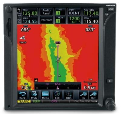
Garmin’s HTAWS system provides visual and aural forward-looking terrain and obstacle avoidance (FLTA) alerts that are fully contained in the GTN 650/750 and GNS 430W/530W. Offering Reduced Protection (RP) mode, Garmin HTAWS works to minimize nuisance alerts during low altitude helicopter operations, while continuing to provide protection from terrain and obstacles. In addition to terrain and obstacle alerting, Garmin HTAWS features voice callouts, which audibly announces height above terrain when descending below 500 feet in 100-foot intervals. With the addition of the GRA 55 radar altimeter, soon required equipment for all Part 135 operators, audible HTAWS call-outs are provided to 50 feet. When combined with HTAWS, Garmin WireAware wire-strike avoidance technology provides alerts to help make seemingly invisible power lines easier to identify within the GTN 650/750. Garmin GTN and GNS WAAS HTAWS solutions are completely self-contained so integration with external equipment is not required,
providing helicopter operators with optimal situational awareness in a single avionics solution.
Owners and operators who invest in a new GTN 650/750 as part of their HTAWS solution will benefit from the many features provided by the touchscreen GPS/NAV/COMM system. Thousands of helicopter owners and operators with existing GNS WAAS and GTN installations may conveniently add HTAWS with a simple software update and the addition of a few annunciators. This policy change gives many helicopter operators an easy path to install Garmin’s safety enhancing HTAWS capabilities with schedule certainty, minimal downtime and a lower cost approval process.
(Image provided with Garmin media advisory)
More News
The Industry Continues to be Rocked By Some Questionable Operations Recent investigations and a great deal of data has resulted in ANN’s SportPlane Resource Guide’s rep>[...]
Make Sure You NEVER Miss A New Story From Aero-News Network Do you ever feel like you never see posts from a certain person or page on Facebook or Instagram? Here’s how you c>[...]
Visual Approach Slope Indicator (VASI) An airport lighting facility providing vertical visual approach slope guidance to aircraft during approach to landing by radiating a directio>[...]
Airport Marking Aids Markings used on runway and taxiway surfaces to identify a specific runway, a runway threshold, a centerline, a hold line, etc. A runway should be marked in ac>[...]
Aero Linx: The Skyhawk Association The Skyhawk Association is a non-profit organization founded by former Skyhawk Pilots which is open to anyone with an affinity for the A-4 Skyhaw>[...]
 Unfortunate... ANN/SportPlane Resource Guide Adds To Cautionary Advisories

