Dart, Flight Management Systems, Partner To Provide Digital Maps | Aero-News Network
Aero-News Network
RSS icon RSS feed
podcast icon MP3 podcast
Subscribe Aero-News e-mail Newsletter Subscribe

Airborne Unlimited -- Most Recent Daily Episodes

Episode Date

Airborne-Monday

Airborne-Tuesday

Airborne-Wednesday Airborne-Thursday

Airborne-Friday

Airborne On YouTube

Airborne-Unlimited-05.20.24

Airborne-Unlimited-05.28.24

Airborne-FlightTraining-05.29.24 Airborne-Unlimited-05.30.24

Airborne-Unlimited-05.24.24

Sat, Jan 09, 2010

Dart, Flight Management Systems, Partner To Provide Digital Maps

System Based On GIS Technology

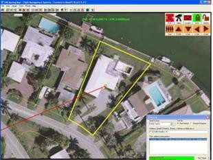
Dart Helicopter Services (DHS) has announced a new distribution agreement with the Flight Management Systems (FMS). The relationship will allow DHS customers access to another useful helicopter accessory: digital moving maps.

“FMS is a leader in digital moving map technology,” said Jeff Shapiro, DHS President. “The relationship is a valuable addition for us. We are excited to be able to work with FMS to offer their map system to our customers.”

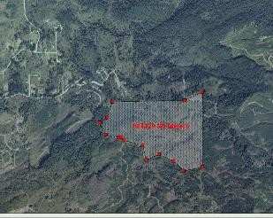
The moving map software utilizes geographic information systems (GIS) to offer more information than conventional scanned paper maps. In addition to being current, the technology enables a user to add as many layers of information as needed. Being able to view the location of potential hazards like cell phone towers and electrical wires, as well as helpful information like underground pipelines, and reverse 911 information, the map can enable the team to quickly and accurately identify a target address. Also, data gathered during a mission can be transferred to another system via USB, making information sharing simple.

“The entire FMS team is excited about the opportunities our relationship with DHS will bring.” FMS president Greg Taylor added “Although we have a presence in several global locations, we will be able to reach those in Europe, an area we haven’t serviced yet.”

FMS leadership has over 32 years of helicopter maintenance, police and aerial fire fighting experience and the company has been flying with the moving map technology since 1996, giving them the experience they need to make recommendations appropriate for any situation.

FMI: www.flightmanagementsystems.com, www.darths.com/

Advertisement

More News

Aero-News: Quote of the Day (05.28.24)

"Clearing this certification hurdle is a major step forward in providing European CJ customers with a solution that not only enhances their aircraft operations but can also extend >[...]

ANN's Daily Aero-Term (05.28.24): Permanent Echo

Permanent Echo Radar signals reflected from fixed objects on the earth's surface; e.g., buildings, towers, terrain. Permanent echoes are distinguished from “ground clutter&rd>[...]

ANN's Daily Aero-Linx (05.28.24)

Aero Linx: Vintage Sailplane Association The purpose of the Vintage Sailplane Association (VSA) is to promote the acquisition, restoration and flying of vintage sailplanes by its m>[...]

Airborne-NextGen 05.21.24: ‘Liberty Lifter’, Cavorite Flies!, Eurodrone

Also: AMA National Fun Fly, Skyfire SF2, Echodyne Gets BVLOS, Av Meteorology Reference General Atomics' run at developing the Liberty Lifter ground effect aircraft has been put to >[...]

Airborne 05.24.24: NPS Kills Rushmore Flyover, VAI v NYC, New Reno Home-Roswell!

Also: Samson Sky, CAF Great Plains Wing, New Cert Standards, Flying Start Day There are, occasionally, blisteringly dunderheaded bits of governmental incompetence to be found with >[...]

blog comments powered by Disqus


Advertisement

Advertisement

Podcasts

Advertisement

© 2007 - 2024 Web Development & Design by Pauli Systems, LC