Mon, May 01, 2017
Intended To Streamline The Commercial Drone Authorization Process
The FAA has published more than 200 facility maps to streamline the commercial drone authorization process. The maps depict areas and altitudes near airports where UAS may operate safely. But drone operators still need FAA authorization to fly in those areas.
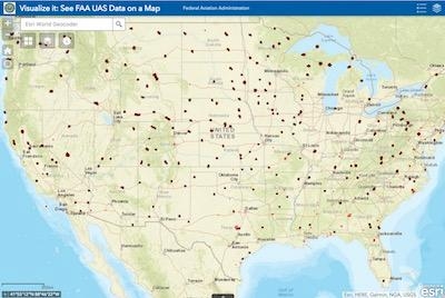
This marks a key first step as the FAA and industry work together to automate the airspace authorization process. The maps will help drone operators improve the quality of their Part 107 airspace authorization requests and help the FAA process the requests more quickly. The maps are informational and do not give people permission to fly drones. Remote pilots must still submit an online airspace authorization application.
Operators may download the map data in several formats, view the site on mobile devices and customize their views. The map viewer displays numbers in grid cells which represent the distances Above Ground Level (AGL) in one square mile up to 400 feet where drones may fly. Zeros indicate critical locations around airports and other aircraft operating areas, like hospital helipads, where no drone flights can be preauthorized. Requests to operate in these areas will require further coordination and FAA safety analysis, which can result in additional safety mitigations to be complied with by the drone operator. Remote pilots can refer to the maps to tailor their requests to align with locations and altitudes when they complete airspace authorization applications. This will help simplify the process and increase the likelihood that the FAA will approve their requests.
FAA air traffic personnel will use the maps to process Part 107 airspace authorization requests. Altitudes that exceed those depicted on the maps require additional safety analysis and coordination to determine if an application can be approved.
Additional maps will be published every 56 days through the end of the year. The updates will coincide with the agency’s existing 56-day aeronautical chart production schedule (PDF). If a map is not yet available, it can be expected in future releases.
The facility maps are an important accomplishment as the FAA collaborates with industry to safely integrate drones into the National Airspace System. They will help improve the safety of drone and traditional aircraft operations. Questions may be directed to the FAA's UAS Integration Office via uashelp@faa.gov or by calling 844-FLY-MY-UA.
(Source: FAA news release)
More News
Airport Marking Aids Markings used on runway and taxiway surfaces to identify a specific runway, a runway threshold, a centerline, a hold line, etc. A runway should be marked in ac>[...]
"It is extremely difficult, if not impossible, for manned aircraft to see a drone while conducting crop-enhancing and other aerial applications at low altitudes and high speeds. We>[...]
Aero Linx: The Skyhawk Association The Skyhawk Association is a non-profit organization founded by former Skyhawk Pilots which is open to anyone with an affinity for the A-4 Skyhaw>[...]
“The T-54A benefits from an active Beechcraft King Air assembly line in Wichita, Kansas, where all required METS avionics and interior modifications are installed on the line>[...]
Aero Linx: Aerostar Owners Association The Association offers the Aerostar Owner a unique opportunity to tap an invaluable source of information concerning the care and feeding of >[...]
 ANN's Daily Aero-Term (04.28.24): Airport Marking Aids

