iFlightPlanner.com Introduces Route Rubberbanding, Custom Waypoints | Aero-News Network
Aero-News Network
RSS icon RSS feed
podcast icon MP3 podcast
Subscribe Aero-News e-mail Newsletter Subscribe

Airborne Unlimited -- Most Recent Daily Episodes

Episode Date

Airborne-Monday

Airborne-Tuesday

Airborne-Wednesday Airborne-Thursday

Airborne-Friday

Airborne On YouTube

Airborne-Unlimited-04.29.24

Airborne-Unlimited-04.23.24

Airborne-Unlimited-04.24.24 Airborne-FltTraining-04.25.24

Airborne-Unlimited-04.26.24

Fri, Jan 21, 2011

iFlightPlanner.com Introduces Route Rubberbanding, Custom Waypoints

Upgraded Airport And Facility Directory Has Over 20,000 Entries

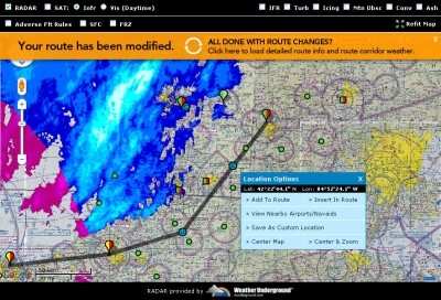
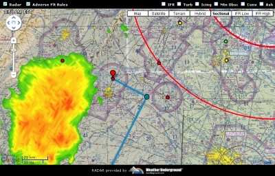
iFlightPlanner, LLC unveiled its highly anticipated upgrade to iFlightPlanner.com this week with the introduction of route rubberbanding and the ability for users to create, save, and use custom waypoints in their flight planning. These latest features build on the existing functionality of iFlightPlanner.com’s sectional and IFR charts in the familiar Google Maps interface by giving pilots the ability to interactively point, click, and drag their routes around weather, airspace, or to any number of custom locations.


iFlightPlanner Screen Shot

iFlightPlanner.com has also upgraded their Airport/Facility Directory (A/FD) by adding graphical and colorcoded facility type and usage identifiers to each listing. These identifiers, along with the ability to sort a directory that includes over 20,000 certified entries down to a manageable size based on user-defined settings, is all geared towards helping pilots get to the information they need as quickly as possible.

These upgrades, which the company is dubbing “iFlightPlanner v2.5”, were the direct result of feedback and interactions users had with  iFlightPlanner.com cofounders John Burnside and Andy Matthews. “We listened to the iFlightPlanner.com community and simply responded with the features they were asking for,” said Matthews, a private pilot and iFlightPlanner.com’s Director of Business Development. “We may want to develop a feature that we think will help pilots plan more efficiently and fly safer, but unless that idea connects with those who are going to use it on a daily basis, it won’t fly.”

Paul Catterson, a private pilot from Parker, Colorado, attests to the weight that user feedback carries at iFlightPlanner.com. “I had sent them a note a few weeks back with some recommendations, received a very timely response, and they contacted me last week to get a preview of the changes they made on my and other pilots' recommendations. And they pretty much nailed everything I had wanted ... and then some!”

As a result of that feedback, iFlightPlanner.com now features a full array of web and mobile-based flight planning utilities which includes an intuitive flight planning wizard that guides pilots through route planning, certified weather briefings, weight & balance calculations, and filing of VFR and IFR flight plans.

Additional iFlightPlanner.com features include:

  • Detailed navigation logs containing forecasted winds, temperatures, fuel burn, and ETAs.
  • Comprehensive Airport/Facility Directory complete with airport diagrams and procedure plates.
  • Searchable Flight Instructor Directory providing CFIs opportunities to build their student base.
  • Full-featured mobile.iFlightPlanner.com accessible from any internet capable device.

All these features are free for anyone who creates an account at iFlightPlanner.com. Premium memberships are also available for $9.95 per month, $24.95 quarterly, or $89.95 annually which include the new custom waypoints feature, a graphical weight & balance calculator, and an enhanced online logbook.

All users have access to the full-featured iFlightPlanner Mobile site via mobile.iFlightPlanner.com.

FMI: www.iFlightPlanner.com

Advertisement

More News

Unfortunate... ANN/SportPlane Resource Guide Adds To Cautionary Advisories

The Industry Continues to be Rocked By Some Questionable Operations Recent investigations and a great deal of data has resulted in ANN’s SportPlane Resource Guide’s rep>[...]

ANN FAQ: Turn On Post Notifications

Make Sure You NEVER Miss A New Story From Aero-News Network Do you ever feel like you never see posts from a certain person or page on Facebook or Instagram? Here’s how you c>[...]

ANN's Daily Aero-Term (04.29.24): Visual Approach Slope Indicator (VASI)

Visual Approach Slope Indicator (VASI) An airport lighting facility providing vertical visual approach slope guidance to aircraft during approach to landing by radiating a directio>[...]

ANN's Daily Aero-Term (04.28.24): Airport Marking Aids

Airport Marking Aids Markings used on runway and taxiway surfaces to identify a specific runway, a runway threshold, a centerline, a hold line, etc. A runway should be marked in ac>[...]

ANN's Daily Aero-Linx (04.28.24)

Aero Linx: The Skyhawk Association The Skyhawk Association is a non-profit organization founded by former Skyhawk Pilots which is open to anyone with an affinity for the A-4 Skyhaw>[...]

blog comments powered by Disqus


Advertisement

Advertisement

Podcasts

Advertisement

© 2007 - 2024 Web Development & Design by Pauli Systems, LC