Mon, Jan 13, 2014
Supported Operations Following Typhoon Haiyan
The inherent intelligence, surveillance and reconnaissance (ISR) capabilities of the Global Hawk Block 30 Unmanned Aerial System were used to support massive international humanitarian assistance and relief efforts following Typhoon Haiyan in the Philippines. Manufacturer Northrop Gurmman says that, due to Global Hawk's long endurance, persistence and range, the aircraft was "the only high altitude asset able to support relief efforts in this critical region of the world on a moment's notice. Global Hawk is also the only high altitude unmanned system able to carry radar, electro-optical (EO) and infrared sensors simultaneously."
On Nov. 14, Global Hawk flew its first of three critical sorties from Guam to the Philippines. It collected 282 wide-area images of the typhoon- ravaged area before returning to Andersen Air Force Base. Rapidly collected EO imagery was quickly relayed to U.S. and Philippine authorities to assist with infrastructure and damage assessments. Imagery also aided in logistical assessments of roads, airports and fields to help relief teams swiftly reach displaced survivors. On Nov. 16 and 20, the U.S. Air Force added the second and third sorties to support relief efforts.
In total, Global Hawk collected approximately 1,000 planned images and a number of ad hoc collections on each sortie. Global Hawk's system flexibility allows for ad hoc retasking to obtain specific pertinent imagery and data. "Mission planning in a crisis is hard, but having the ability to task and retask Global Hawk gives commanders the flexibility to conduct productive ISR missions that feed near real-time information to the response teams who need it the most," said Jim Culmo, Northrop Grumman's vice president, High Altitude Long Endurance Enterprise, Northrop Grumman.
When disaster strikes, understanding the magnitude of destruction left in the wake of the event is critical. NGC says Global Hawk's EO imagery covers large regions with high-resolution detail in support of vital life-saving operations.
Global Hawk's first humanitarian mission took place in 2007, as Southern California fought major fires. In 2010, Global Hawk supported international requests for surveillance following the Haiti earthquake. Similarly, the Global Hawk collected data and imagery within the dangerous radiation zones over the Fukushima power plant following Japan's 2011 earthquake and tsunami disaster.
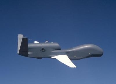
(Global Hawk image from file)
More News
How To Get A Story On Aero-TV News/Feature Programming How do I submit a story idea or lead to Aero-TV? If you would like to submit a story idea or lead, please contact Jim Campbel>[...]
Aero Linx: International Association of Professional Gyroplane Training (IAPGT) We are an Association of people who fly, build or regulate Gyroplanes, who have a dream of a single >[...]
NORDO (No Radio) Aircraft that cannot or do not communicate by radio when radio communication is required are referred to as “NORDO.”>[...]
Also: uAvionix AV-Link, F-16 Viper Demo, TN National Guard, 'Staff the Towers' A Saturday afternoon jump run, originating from SkyDive Kansas City, went bad when it was reported th>[...]
Beyond Visual Line Of Sight (BVLOS) The operation of a UAS beyond the visual capability of the flight crew members (i.e., remote pilot in command [RPIC], the person manipulating th>[...]
 ANN FAQ: Contributing To Aero-TV