Aero-TV: The Portable AV8OR Ace - Raising the Bar on Capabilities | Aero-News Network
Aero-News Network
RSS icon RSS feed
podcast icon MP3 podcast
Subscribe Aero-News e-mail Newsletter Subscribe

Airborne Unlimited -- Most Recent Daily Episodes

Episode Date

Airborne-Monday

Airborne-Tuesday

Airborne-Wednesday Airborne-Thursday

Airborne-Friday

Airborne On YouTube

Airborne-Unlimited-04.29.24

Airborne-NextGen-04.30.24

Airborne-Unlimited-05.01.24 Airborne-AffordableFlyers--05.02.24

Airborne-Unlimited-05.03.24

Tue, Dec 01, 2009

Aero-TV: The Portable AV8OR Ace - Raising the Bar on Capabilities

Honeywell’s AV8OR ACE Enables Increased Paperless Cockpit Capabilities

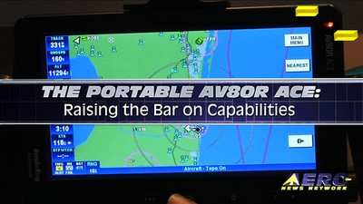
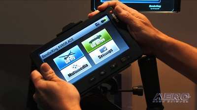
At EAA AirVenture 2009, Honeywell introduced their next evolution in avionics products, the Bendix/King AV8OR ACE, at an introductory price of only $1999. Offering a seven-inch display, the AV8OR ACE includes a sunlight-readable touchscreen interface for easy viewing and usage; the “Touch and See” capability allows users to simply tap on screen objects, such as airports, VORs, and airspace boundaries, to quickly access further information. Customers can use aviation navigation in either portrait or landscape modes.

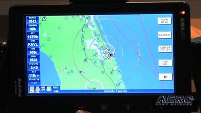
The lightweight design also features FAA IFR geo-referenced charts, eliminating the need to carry paper charts in travel. The AV8OR ACE dramatically increases situational awareness by providing aircraft location display directly on High and Low en route charts, approach plates, and airport taxiway diagrams. Customers can obtain digital charts and approach charts from Bendix-King's vendor.

The AV8OR ACE includes a WAAS GPS system, automotive navigation, regional databases, and flight guide airport services data including fuel pricing, FBO information, and local facilities guidance.  The unit’s multimedia functionality and Bluetooth capability allows for data linkage with Bluetooth-enabled phones, alternative GPS receiver, and XM weather receiver. 

The weather interface supports WxWorx, allowing the AV8OR ACE to display real-time weather information overlaid in detail on a moving map, including graphical METARs, AIRMETs, SIGMETS, and PIREPs.

FMI: https://www.bendixking.com/AV8OR/ACE/index.html, https://www.bendixking.com/AV8OR/, http://www.aero-tv.net, http://www.youtube.com/aerotvnetwork, http://twitter.com/AeroNews

Advertisement

More News

ANN's Daily Aero-Term (05.02.24): Touchdown Zone Lighting

Touchdown Zone Lighting Two rows of transverse light bars located symmetrically about the runway centerline normally at 100 foot intervals. The basic system extends 3,000 feet alon>[...]

Aero-News: Quote of the Day (05.02.24)

“Discovery and innovation are central to our mission at Virgin Galactic. We’re excited to build on our successful record of facilitating scientific experiments in subor>[...]

Aero-News: Quote of the Day (05.03.24)

"We are reaching out to you today on behalf of the Popular Rotorcraft Association because we need your help. We are dangerously close to losing a critical resource that if lost, wi>[...]

ANN's Daily Aero-Term (05.03.24): UAS Traffic Management (UTM)

UAS Traffic Management (UTM) The unmanned aircraft traffic management ecosystem that will allow multiple low altitude BVLOS operations and which is separate from, but complementary>[...]

ANN's Daily Aero-Linx (05.03.24)

Aero Linx: Society of Aviation and Flight Educators (SAFE) SAFE is a member-oriented organization of aviation educators fostering professionalism and excellence in aviation through>[...]

blog comments powered by Disqus


Advertisement

Advertisement

Podcasts

Advertisement

© 2007 - 2024 Web Development & Design by Pauli Systems, LC