Mon, Mar 18, 2019
The Easy-To-Use Hardware Device Enables 4G And Satellite Connectivity To UTM System For Unmanned Aircraft
Drone airspace management provider AirMap and Honeywell have announced the development of a cost-effective drone tracking solution to provide airspace safety authorities with situational awareness of manned and unmanned aircraft operations within an airspace system.

Together, the companies will develop a cost-effective hardware device to allow for unmanned aerial systems (UAS), or drones, to maintain consistent communication with a UAS Traffic Management (UTM) system. UTM is a digital air traffic management system made up of technologies and services designed to maintain safe integration and separation of drones and other aircraft and objects in low-altitude airspace via the exchange of mission-critical data and telemetry information.
The drone tracking solution co-developed by AirMap and Honeywell will support multiple communication options, including 4G and satellite in areas without 4G coverage, for the broadcast of real-time drone telemetry feeds to a UTM system. The AirMap UTM Platform ingests telemetry feeds from a variety of hardware- and software-based solutions for visualization, monitoring, and deconfliction by air navigation service providers (ANSP) and other relevant authorities.
"The AirMap UTM Platform is designed to provide a real-time operating picture of the airspace for both manned and unmanned aircraft," said Ben Marcus, AirMap Chairman and Co-founder. "We've partnered with Honeywell to deliver an easy-to-use, cost-effective, and drone-agnostic device as a practical way to start managing drone traffic in any environment, today."
Honeywell is an investor in AirMap and uses AirMap's application programming interfaces (API) for industrial customers in operations such as inspecting power lines and downstream oil and gas equipment.
The tracker device is available today as a proof of concept for testing.
(Source: Airmap news release)
More News
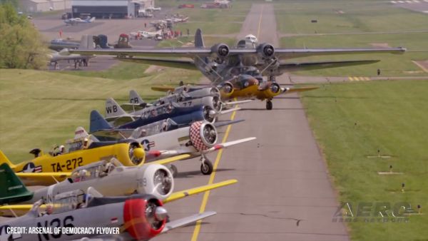
“Warbirds in Review features veterans, aviation legends, and aircraft that simply cannot be seen together in one place anywhere else in the world. Many of these veterans main>[...]
Also: VAI v Anti-Heli Actions, Electric Aircraft Symposium, 2024 FAA Drone/AAM Symposium, Gravitymaster Blue Origin's seventh passenger flight ended with a smidgeon of drama when o>[...]
“The importance of this YF-16 paint scheme is celebrating 50 years of the F-16 Viper. Everyone at Edwards has a big sense of pride for not only supporting the Viper Demo Team>[...]
Aero Linx: National Aeronca Association We are dedicated to supporting the design and preserving the history of Aeronca aircraft. Founded by Jim Thompson and fostered by his leader>[...]
Klyde Sounds Like He's Defining An 'Influencer' FMI: www.klydemorris.com>[...]
 Aero-News: Quote of the Day (05.25.24)