WSI Says New Version Optimizes Pre-Flight Weather Decision
Support
A new, online version of WSI's Pilotbrief service has been
launched by the Weather Service International. The service allows
pilots to quickly receive a "clear and actionable" view of
potential weather impacts and optimize plans accordingly. The
company says the benefits include quicker aircraft turnaround times
and improved mission planning and safety, among others.
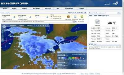
The WSI Pilotbrief Optima service's new mapping engine allows
high definition convective weather depiction and enhanced global
overlays. When combined with flight plan and airspace overlays, the
high definition weather information improves route planning and
builds confidence in decision making. The new release
also enables a high level of personalization and 'mid-task'
customization to further streamline pilot workflow.
"The release of WSI Pilotbrief Optima underscores our commitment to
extend WSI's leadership position in global aviation
weather-decision-support by delivering early insight into
disruptive weather conditions, no matter where pilots operate,"
said Mark D. Miller, VP of WSI's Decision Support.
Enhanced Pilotbrief Optima Features:
High Definition (HD) Map - This powerful new mapping engine
combines unrivalled performance, high fidelity and personalization
to take the guess work out of mission planning.
High Definition (HD) Weather Layers - This includes enhanced
Radar, Satellite IR, Vertically Integrated Liquid (VIL) and EchoTop
mosaics. Most notably, the new EchoTop mosaic offers a four-
fold improvement in spatial resolution that clearly shows the
highest tops of greatest concern, improving confidence in route
planning and decision making.
Global Lightning - With an optional overlay to WSI's
proprietary Global Lightning Network (GLN), pilots can quickly
identify areas of strongest convective activity outside
ground-based weather radar range.
SATrad - Derived from satellite imagery and high resolution
model data, WSI's proprietary SATrad provides a synthesized
depiction of convection throughout the tropics. When
combined with global lightning, pilots can pinpoint the areas of
strongest convection to avoid, improving safety and passenger
comfort.
Enhanced Airport and Route Briefings - WSI's proprietary
briefing engine delivers the most relevant weather and NOTAM
information for your mission in a compact, easy to read and highly
transportable briefing package.
Over the next few months, WSI plans to release Pilotbrief Optima
for iPad, a lock-down browser version, and a kiosk version for
FBOs.
Very High Frequency The frequency band between 30 and 300 MHz. Portions of this band, 108 to 118 MHz, are used for certain NAVAIDs; 118 to 136 MHz are used for civil air/ground voi>[...]
Aero Linx: Aviation Suppliers Association Established February 25, 1993, the Aviation Suppliers Association (ASA), based in Washington, D.C., is a not-for-profit association, repre>[...]
Have A Story That NEEDS To Be Featured On Aero-News? Here’s How To Submit A Story To Our Team Some of the greatest new stories ANN has ever covered have been submitted by our>[...]
From 2021 (YouTube Version): Colorado Campus Offers aVariety Of Aerospace Entertainment And Education Wings over the Rockies Exploration of Flight is the second location for the Wi>[...]
Also: Paramotor Champ's, Electric Ultralight, ICON BK Update, Burt Rutan at Oshkosh! The Popular Rotorcraft Association is reaching out for help in rebuilding their private runway >[...]
 ANN's Daily Aero-Term (05.17.24): Very High Frequency

