Will Help Facilitate More Advanced Operations For Drones And Help Lay The Groundwork For Future UTM
NUAIR (Northeast UAS Airspace Integration Research) in collaboration with ANRA Technologies conducted an operational assessment of ANRA’s UAS traffic management (UTM) technology for broadcast and network based remote identification (RID) of unmanned aircraft systems (UAS) at the New York UAS Test Site located at Griffiss International Airport in Rome, NY.

Remote ID is the ability of a UAS in flight to provide identification information that can be received by other parties. Remote ID will help facilitate more advanced operations for drones and help lay the groundwork for future UTM.
Remote ID will assist the FAA, law enforcement, and Federal security agencies when a UAS appears to be flying in an unsafe manner or where the drone is not allowed to fly.
On May 28-29, staff from NUAIR assessed ANRA’s first-of-its kind technology using draft industry standards for evaluating both broadcast and network based remote identification capabilities. Several drones were flown by NUAIR staff, with two carrying a unique Wi-Fi broadcast module provided by ANRA and Doodle Labs, to test RID broadcast capability.
Overall, the event was deemed successful for being the first operational assessment of both broadcast and network capability.
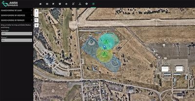
Part of the assessment included multiple UAS Service Suppliers (USS) at the test site using ANRA’s UTM software to manage drone operations while also serving as the network RID service and display provider. The display applications ingested broadcast RID data and/or interacted with a network RID display provider to present information to the end users.
The broadcasting drones transmitted RID advertisements continuously and a Display App on a smartphone used the smartphone’s technology to listen for the drone advertisements, extracted the RID data, and then displayed the live drone location on a map along with its historical path.
Additionally, network publishing was evaluated using ANRA’s Software Platform to visualize data within an internet-based service area. In this case, the Display App made a request to ANRA network RID display provider which had aggregated RID data for all flights in the area managed by network RID service providers and provided the aggregated data back to the Display App.
Broadcast remote ID was received and viewed on ANRA displays by Oneida County Sheriff personnel who participated in the assessment using a mobile app and password protection.
“This test of ANRA’s remote identification technology is further evidence of how innovation and collaboration continue to blossom at Oneida County’s UAS Test Site at Griffiss International Airport,” said Oneida County Executive Anthony J. Picente Jr. “This new tool will prove vital in the traffic management and public safety of unmanned aircraft systems and continue to push the industry forward.”
To further the industry, ANRA and its partner Doodle Labs also announced their decision to open source the broadcast based Remote ID firmware implementation which can be used for any Linux compatible Wi-Fi hardware module.
Another aspect of the assessment included testing a public facing mobile app that provides information about participating drones, such as if the drone was being flown by an approved FAA operator.
“We are thrilled to test our technology to advance commercial drone operations. ANRA is committed to safe and efficient drone operations and we know that starts with gaining public trust.” said Amit Ganjoo, CEO ANRA Technologies. “The app is just one feature of many features of ANRA’s remote ID technology that was assessed.”
The Oneida County Sheriff’s Office whole heartedly supports the mission statement of NUAIR and ANRA Technologies pertaining to the broadcast of Remote ID.
“Any opportunity to effectively engage in the community that places emphasis on the ability to educate and creates a safe environment, all participants benefit,” stated Chief Deputy Jonathan Owens.
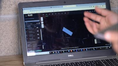
(Images provided with NUAIR news release)
 ANN's Daily Aero-Term (05.09.24): Hold Procedure

