Hearing Focuses On Proposed LightSquared Network
The U.S. House Committee on Science, Space, and Technology held
a hearing Thursday to examine concerns and issues associated with
interference on the GPS signal from the proposed LightSquared LLC
terrestrial broadband network related to Federal scientific
activities.
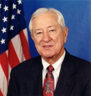
In his opening remarks, Chairman Ralph Hall (R-TX)
(pictured) discussed the varied economic, practical and
national security-related benefits of the GPS system, and all of
the industries that depend on it. “Any potential disruption
to GPS, and the science activities that it supports, is of utmost
concern to this Committee,” Hall said. “We have to find
a way to open up more spectrum for broadband, but not at the
expense of GPS.”
“Ensuring that GPS is protected is a vital national interest.
Its economic impact is clear, and its utility to science is
unquestionable, but what is also important is the real impact on
lives,” Hall continued. “Last month the FAA announced
that LightSquared’s previous proposal would result in
billions of dollars of investment lost, a decade of delays to
ongoing projects, a cost impact of roughly $72 billion, and almost
800 additional fatalities – and that is just one
Administration.”

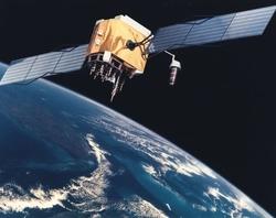
LightSquared is seeking approval from regulators at the Federal
Communications Commission (FCC) to build a $14 billion broadband
network using airwaves previously reserved for satellites. Recent
testing has demonstrated the potential for interference that could
disable the GPS signal used for critical U.S. Government services
and science missions.
Discussing the importance of GPS to natural disaster prediction and
response capabilities, Ms. Mary Glackin, Deputy Under Secretary of
the National Oceanic and Atmospheric Administration (NOAA), said
that LightSquared’s original spectrum plan would “cause
serious performance degradation or a total loss of mission for a
wide range of our operational systems, resulting in the loss of
critical services and potential loss of life and
property.” Ms. Glackin continued, “Our entire
fleet of meteorological satellites would be put at
risk.”
Similarly, Dr. David Applegate, Associate Director for Natural
Hazards at the U.S. Geological Survey (USGS) said that “GPS
is vitally important in acquiring virtually every type of spatially
referenced data in use today.” As one example,
Dr. Applegate noted that fire crews use GPS for navigation, and
that any degradation of the GPS signal “could make it more
difficult for personnel to navigate” and that “they
would have to revert to pencil-and-map.” He said,
“Miscommunication and delays also would be a life-safety risk
for personnel and the public.”
Mr. Anthony Russo, Director of the National Coordination Office
for Space-Based Positioning, Navigation and Timing, which oversees
U.S. agencies’ interests in GPS services, said that extensive
testing “conclusively demonstrates harmful interference from
LightSquared’s intended deployment of their high power
terrestrial broadband system.”
Since initial testing, LightSquared has modified its proposal,
though its network will still be located in the same frequency band
as their satellite service, which is adjacent to existing GPS
spectrum. Regarding LightSquared’s revised proposal, Mr.
Russo bluntly said that “Further study is
needed.”
Echoing the necessity for further testing, Dr. Victor Sparrow, who
directs spectrum policy and space communications at NASA, said that
impacts to the agency’s GPS-dependent systems “would be
substantial.” Sparrow also said it is clear to NASA
that even with LighSquared’s modified plan, GPS interference
issues have not been satisfied.
Dr. Scott Pace, Director of the Space Policy Institute at George
Washington University, discussed the many ways that GPS has
benefited the scientific community. However, Dr. Pace said that
“If the LightSquared terrestrial network is allowed to
operate as proposed, it will mark a permanent decline in the
beneficial capabilities GPS has afforded scientific users in the
United States.” He continued, “It would create new,
additional, and unforeseen, costs for federal science agencies as
well as State and local governments who rely on high precision
GPS-derived data.”
 Aero-TV: DeltaHawks Diesel Power Steps Into the Spotlight

