Wed, Sep 25, 2019
Airplane Clipped Trees Before Impacting Terrain
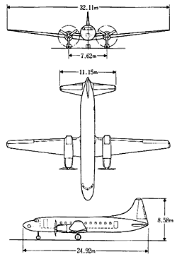
The NTSB has released its preliminary report from an accident involving a Convair 440 that impacted trees and terrain while on final approach to runway 25 at the Toledo Express Airport (KTOL). The accident site was located about 1/2-mile from the runway arrival threshold in Monclova, Ohio. Both pilots were fatally injured. The airplane was destroyed by impact forces and a postimpact fire. The airplane was registered to a private individual and operated by Ferreteria E Implementos San Francisco as a non-scheduled cargo flight. Night visual meteorological conditions prevailed, and the flight was being operated on an instrument flight rules flight plan. The flight originated from the Millington-Memphis Airport (KNQA), Millington, Tennessee, at 2314 central daylight time and was destined for KTOL.
According to the operator, the flight crew initially departed Laredo International Airport (KLRD) about 1838 central time the evening before the accident and arrived at NQA about 2210 central time. The airplane was refueled before departing on the accident flight.
Preliminary air traffic control position data depicted the airplane proceeding direct to KTOL after departure from KNQA at a cruise altitude of 7,000 ft mean sea level. About 39 miles southwest of KTOL, the airplane entered a cruise descent in preparation for approach and landing. The flight crew was subsequently cleared to land at 0235 when the airplane was about 5 miles southeast of KTOL. The pilot acknowledged the landing clearance; however, no further communications were received. The airplane ultimately became established on final approach for runway 25 before radar contact was lost. No problems or anomalies were reported during the flight.
The airplane struck trees beginning about 0.12-mile east of the accident site; about 0.65-mile northeast of the runway arrival threshold. The initial strikes were about 55 ft above ground level. Multiple tree breaks were observed along the flight path through the wooded area east of the accident site. A ground impact scar was located west of the wooded area and led to the accident site. The impact path was oriented on a westerly heading. The airplane came to rest in a parking lot about 0.50-mile from the threshold and near the extended centerline of the runway.
(Source: NTSB. Image from file)
More News
Hold Procedure A predetermined maneuver which keeps aircraft within a specified airspace while awaiting further clearance from air traffic control. Also used during ground operatio>[...]
Altitude Readout An aircraft’s altitude, transmitted via the Mode C transponder feature, that is visually displayed in 100-foot increments on a radar scope having readout cap>[...]
Aero Linx: European Hang Gliding and Paragliding Union (EHPU) The general aim of the EHPU is to promote and protect hang gliding and paragliding in Europe. In order to achieve this>[...]
Also: Skydio Chief, Uncle Sam Sues, Dash 7 magniX, OR UAS Accelerator US Secretary of the Air Force Frank Kendall was given a turn around the patch in the 'X-62A Variable In-flight>[...]
"The need for innovation at speed and scale is greater than ever. The X-62A VISTA is a crucial platform in our efforts to develop, test and integrate AI, as well as to establish AI>[...]
 ANN's Daily Aero-Term (05.09.24): Hold Procedure

