LiDAR-Equipped Aircraft Employed By History Channel In Search For Lost Gold
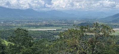
In a remote region of the Philippines lies a mystery as deep as the jungle it inhabits. Legend has it that, in 1945, Japanese General Tomoyuki Yamashita buried billions worth of stolen treasure in tunnels deep within the jungle, leaving behind only a series of mysterious symbols.
Many have sought the existence of this vast treasure, including Winston Churchill, but modern drone technology might finally provide some answers to one of the last great mysteries of World War II.
History’s Lost Gold of World War II will be airing an episode about the mystery, which features a team of PrecisionHawk experts that assisted in the quest for the buried treasure. The team—Jaime Young, Director of LiDAR; Jill Wrenn, LiDAR Scientist; and Matt Tompkins, Director of Flight Operations, LiDAR—was certainly up for the challenge and traveled more than 7,000 miles to take part in the adventure.
First, the team evaluated the area of interest and developed flight requirements: History's mission would take them deep into the mountainous jungle. So, they needed a heavy-duty system that could put up with a wet environment and a sophisticated flight platform that would enable them to safely execute missions over varying terrain. So, they readied PrecisionHawk’s standard LiDAR configuration: a DJI M600 with a Riegl Minivux LiDAR sensor payload, paired with a SONY A6000 visual camera. They also packed a Paracosm handheld LiDAR sensor. This would come in handy for collecting data in caves and pits, as well as in forested areas that would require higher point cloud density than what could be captured from above the canopy.
To fly the mountainous terrain, Matt uploaded a high-fidelity digital elevation model into PrecisionFlight Pro—PrecisionHawk’s flight software of choice for most commercial missions. It would enable Matt to fly the drone such that it would safely “follow” the mountainous terrain at a consistent distance above ground level.
Finally, to process LiDAR data on-site, Jamie and Jill brought laptops with major processing power. Ultimately, the team had a complete data platform, enabling them to collect data, process it, and deliver rich 3D models, even in the most remote of locations.
Once the team had their gear together, they traveled by small aircraft to a rural airport and then drove by vehicle deep into our jungle base camp.
Arriving at such a remote location was not without challenges, especially with the Monsoon season in full effect. But PrecisionHawk’s team was well-equipped to navigate the dense jungle to help the series’ crew discover artifacts, tracks, trails, or anything that might suggest such an event had taken place where human excursion is rare. Matt deployed the drone-based LiDAR, penetrating thick canopy and dense fog to sense the jungle floor. “LiDAR was the best solution to cover a large area that is inaccessible and dangerous to explore on foot,” Matt said.
“The drone method was probably one of the best methods because we could fly closer to the ground with all that dense vegetation,” Jill said. “We flew it [at] a few different angles so it would penetrate through the trees and produce an accurate ground surface.”
The team also used the ground-based LiDAR sensor to determine if there were any areas of interest in and around a cave area. Using drones to capture the data was more viable than using traditional mapping methods. Photogrammetry is unable to penetrate dense surface areas, “and in terms of traditional LiDAR methods, if you were to take an airplane to the location, it would be a logistical nightmare, making it cost-prohibitive.” Jaime said.
Using drones, however, the team captured all the data necessary in just half a day. This accelerated the treasure hunt, givIng the crew a lot more insight into where it might need to look.
As for processing the data, it became a visualization tool. Basically, “[it] was a map to help [the crew] find areas of interest they might not have seen exploring by foot,” Matt said. These “areas of interest” might hold clues in helping to solve the mystery.
The PrecisionHawk team also enhanced the data by converting it into MAYA format, which produces an animated, full-motion 3D model that is widely used in the motion picture industry. The results of what the data might have led to? That remains a mystery—at least until airing.
(Image provided with PrecisionHawk news release)
 ANN's Daily Aero-Term (05.09.24): Hold Procedure

