Russia Reportedly Digitally Modified Satellite Photos After MH17 Shootdown | Aero-News Network
Aero-News Network
RSS icon RSS feed
podcast icon MP3 podcast
Subscribe Aero-News e-mail Newsletter Subscribe

Airborne Unlimited -- Most Recent Daily Episodes

Episode Date

Airborne-Monday

Airborne-Tuesday

Airborne-Wednesday Airborne-Thursday

Airborne-Friday

Airborne On YouTube

Airborne-Unlimited-05.06.24

Airborne-NextGen-04.30.24

Airborne-Unlimited-05.01.24 Airborne-AffordableFlyers--05.02.24

Airborne-Unlimited-05.03.24

Wed, Jun 03, 2015

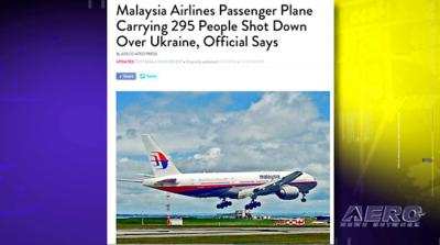
Russia Reportedly Digitally Modified Satellite Photos After MH17 Shootdown

Blamed Ukrainian Forces For The Loss Of The Airliner

A British "citizen journalist" says he has found evidence that Russia digitally altered satellite images to place blame for the shooting down of Malaysian Airlines Flight 17 last year on Ukraine.

The journalist is Eliot Higgins, the founder of the website Bellingcat. He said he used publicly available satellite images from Google Earth Pro as the basis for his research. He found that images of the site where Russia says the Ukrainian missile launcher that reportedly brought down the jet was located were digitally altered using Photoshop CS5.

A post dated May 31 on the Bellingcat site said that the images used by the Russian Ministry of Defense that it said shows Buk missile launchers used to bring down the airliner were captured in June 2014. It also says that the photos are incorrectly dated, and the "error level analysis of the images also reveal the images have been edited. This includes a Buk missile launcher that was removed to make it appear that Buk missile launcher was active on July 17th, and imagery where Buk missile launchers were added to make it appear they were within attack range of Flight MH17."

Higgins says that his research refutes all four claims made by the Russian Defense Ministry in a news conference shortly after the plane went down.

FMI: www.bellingcat.com

Advertisement

More News

ANN's Daily Aero-Term (05.02.24): Touchdown Zone Lighting

Touchdown Zone Lighting Two rows of transverse light bars located symmetrically about the runway centerline normally at 100 foot intervals. The basic system extends 3,000 feet alon>[...]

Aero-News: Quote of the Day (05.02.24)

“Discovery and innovation are central to our mission at Virgin Galactic. We’re excited to build on our successful record of facilitating scientific experiments in subor>[...]

Aero-News: Quote of the Day (05.03.24)

"We are reaching out to you today on behalf of the Popular Rotorcraft Association because we need your help. We are dangerously close to losing a critical resource that if lost, wi>[...]

ANN's Daily Aero-Term (05.03.24): UAS Traffic Management (UTM)

UAS Traffic Management (UTM) The unmanned aircraft traffic management ecosystem that will allow multiple low altitude BVLOS operations and which is separate from, but complementary>[...]

ANN's Daily Aero-Linx (05.03.24)

Aero Linx: Society of Aviation and Flight Educators (SAFE) SAFE is a member-oriented organization of aviation educators fostering professionalism and excellence in aviation through>[...]

blog comments powered by Disqus


Advertisement

Advertisement

Podcasts

Advertisement

© 2007 - 2024 Web Development & Design by Pauli Systems, LC