Four Lost In Georgia Bonanza Accident | Aero-News Network
Aero-News Network
RSS icon RSS feed
podcast icon MP3 podcast
Subscribe Aero-News e-mail Newsletter Subscribe

Airborne Unlimited -- Most Recent Daily Episodes

Episode Date

Airborne-Monday

Airborne-Tuesday

Airborne-Wednesday Airborne-Thursday

Airborne-Friday

Airborne On YouTube

Airborne-Unlimited-04.22.24

Airborne-Unlimited-04.16.24

Airborne-FlightTraining-04.17.24 Airborne-AffordableFlyers-04.18.24

Airborne-Unlimited-04.19.24

Join Us At 0900ET, Friday, 4/10, for the LIVE Morning Brief.
Watch It LIVE at
www.airborne-live.net

Sun, Feb 11, 2007

Four Lost In Georgia Bonanza Accident

Plane Disappears From Radar After Cleared To Descend

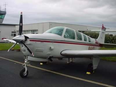
A Beechcraft Bonanza 36 crashed in a training area on Fort Stewart, GA, killing four people Friday night, according to the Associated Press.

The plane (file photo of type, above) was en route to Anderson, SC, from Titusville, FL, when it went down, said FAA spokeswoman Kathleen Bergen. The cause of the crash is under investigation.

NTSB officials say the Bonanza was flying at 13,000 feet when the pilot requested a lower altitude. The pilot was cleared for 11,000 feet and as the plane began its descent, disappeared from radar.

"Air traffic control lost contact with the flight at about 6:15 pm," Bergan said. "The wreckage wasn't found until almost midnight."

It took emergency responders more than five hours to find the wreckage in a heavily wooded area on the vast Army post, said Fort Stewart spokesman Kevin Larson.

Larson added the plane went down in a densely-wooded training area about six miles west of the post's garrison where Fort Stewart's headquarters, barracks and motorpools are located.

Four bodies were found among the wreckage, he said. Their identities were not released.

Bergen said the plane was following a flight plan approved by ATC and did not appear to be violating any airspace restrictions.

Fort Stewart has the largest land area of any Army post east of the Mississippi River, covering about 430 square miles. Most of the area is heavily wooded and used for training.

FMI: www.ntsb.gov, www.stewart.army.mil

Advertisement

More News

ANN's Daily Aero-Term (04.25.24): Airport Rotating Beacon

Airport Rotating Beacon A visual NAVAID operated at many airports. At civil airports, alternating white and green flashes indicate the location of the airport. At military airports>[...]

ANN's Daily Aero-Linx (04.25.24)

Aero Linx: Fly for the Culture Fly For the Culture, Inc. is a 501(c)(3) non-profit organization that serves young people interested in pursuing professions in the aviation industry>[...]

Klyde Morris (04.22.24)

Klyde Is Having Some Issues Comprehending The Fed's Priorities FMI: www.klydemorris.com>[...]

Airborne 04.24.24: INTEGRAL E, Elixir USA, M700 RVSM

Also: Viasat-uAvionix, UL94 Fuel Investigation, AF Materiel Command, NTSB Safety Alert Norges Luftsportforbund chose Aura Aero's little 2-seater in electric trim for their next gli>[...]

Airborne 04.22.24: Rotor X Worsens, Airport Fees 4 FNB?, USMC Drone Pilot

Also: EP Systems' Battery, Boeing SAF, Repeat TBM 960 Order, Japan Coast Guard H225 Buy Despite nearly 100 complaints totaling millions of dollars of potential fraud, combined with>[...]

blog comments powered by Disqus


Advertisement

Advertisement

Podcasts

Advertisement

© 2007 - 2024 Web Development & Design by Pauli Systems, LC