NTSB Prelim: Beech A36 | Aero-News Network
Aero-News Network
RSS icon RSS feed
podcast icon MP3 podcast
Subscribe Aero-News e-mail Newsletter Subscribe

Airborne Unlimited -- Most Recent Daily Episodes

Episode Date

Airborne-Monday

Airborne-Tuesday

Airborne-Wednesday Airborne-Thursday

Airborne-Friday

Airborne On YouTube

Airborne-Unlimited-05.19.25

Airborne-NextGen-05.20.25

AirborneUnlimited-05.21.25

Airborne-AffordableFlyers-05.22.25

AirborneUnlimited-05.23.25

Sun, Nov 12, 2023

NTSB Prelim: Beech A36

Witness Observed The Airplane As It Cleared A Group Of Trees By About 20 Ft While It Continued Its Left Turn

Location: Covelo, CA Accident Number: WPR24FA018
Date & Time: October 20, 2023, 18:01 Local Registration: N8248K
Aircraft: Beech A36 Injuries: 2 Fatal
Flight Conducted Under: Part 91: General aviation - Personal

On October 20, 2023, about 1801 Pacific daylight time, a Beechcraft A36, N8248K, was destroyed when it was involved in an accident near Covelo, California. The pilot and passenger were fatally injured. The airplane was operated as a Title 14 Code of Federal Regulations Part 91 personal flight.

According to a witness, the airplane lifted off the runway surface near the departure end of runway 28 at Round Valley Airport (O09), Covelo, California. The airplane began a left turn towards the northwest in a nose high attitude before it disappeared from the witness’ view. About this time, a second witness observed the airplane as it cleared a group of trees by about 20 ft while it continued its left turn in the same direction from about 60 ft above ground level. As the airplane turned towards the south its bank angle increased to about 70° and the airplane subsequently descended into the ground. The airplane exploded after it  impacted the ground and a postcrash fire ensued.

The airplane came to rest on a hillside about 0.40 nm west of the departure end of runway 28 at a field elevation of about 1,500 ft mean sea level oriented on a northeasterly heading. The airplane’s major structures were all accounted for at the accident site. The first point of impact (FPI) was marked by several trees about 20 feet tall with broken tree tops and broken branches at the base of each tree. A 50 foot long debris path was traced from the FPI to the main wreckage, which was mostly consumed by postcrash fire.

FMI: www.ntsb.gov

Advertisement

More News

Aero-FAQ: Dave Juwel's Aviation Marketing Stories -- ITBOA BNITBOB

Dave Juwel's Aviation Marketing Stories ITBOA BNITBOB ... what does that mean? It's not gibberish, it's a lengthy acronym for "In The Business Of Aviation ... But Not In The Busine>[...]

Airborne 05.19.25: Kolb v Tornados, Philippine Mars, Blackhawk Antler Theft

Also: Tentative AirVenture Airshow Lineup, Supersonic Flight Regs, Private Pilot Oral Exam Guide, Boeing Deal The sport aircraft business can be a tough one... especially when Moth>[...]

Klyde Morris (05.19.25)

Klyde Gets Nervous... Is Crazy Mike Enough? FMI: www.klydemorris.com>[...]

Airborne-NextGen 05.20.25: Drone Regs, Zero-Emission Cargo, Door-Dash Drone

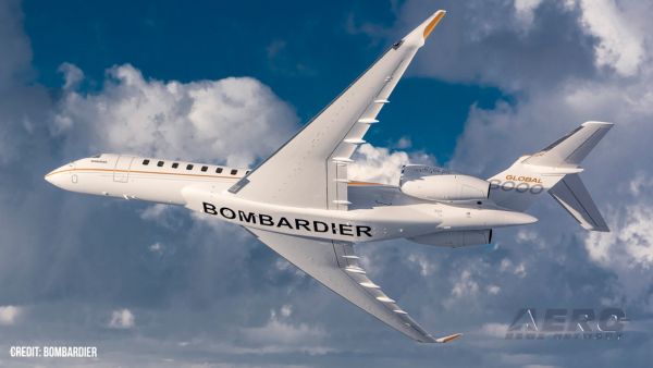
Also: Blackhawk’s Replacement, Supersonic Flight, Archer 1Q/25, Long-Range VTOL Program U.S. Secretary of Transportation Sean P. Duffy released an update on progress being ma>[...]

Airborne Affordable Flyers 05.22.25: RV-15 Finalizing, OSH NOTAM, Kolb v Tornado

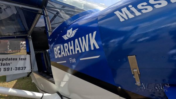
Also: Elektra Solar Trainer, U.S. Nationals Update, SeaMax M-22 Catches Fire, Bearhawk Aircraft At SUN ‘n FUN The Vans Aircraft engineering team recently provided its spring >[...]

blog comments powered by Disqus


Advertisement

Advertisement

Podcasts

Advertisement

© 2007 - 2025 Web Development & Design by Pauli Systems, LC