Lufthansa Systems Presents A New Drone App For Consumers And Regulators | Aero-News Network
Aero-News Network
RSS icon RSS feed
podcast icon MP3 podcast
Subscribe Aero-News e-mail Newsletter Subscribe

Airborne Unlimited -- Most Recent Daily Episodes

Episode Date

Airborne-Monday

Airborne-Tuesday

Airborne-Wednesday Airborne-Thursday

Airborne-Friday

Airborne On YouTube

Airborne-Unlimited-04.01.24

Airborne-Unlimited-04.09.24

Airborne-Unlimited-04.10.24 Airborne-Unlimited-04.11.24

Airborne-Unlimited-04.12.24

Join Us At 0900ET, Friday, 4/10, for the LIVE Morning Brief.
Watch It LIVE at
www.airborne-live.net

Tue, Mar 06, 2018

Lufthansa Systems Presents A New Drone App For Consumers And Regulators

To Be Introduced At The World ATM Congress In Madrid

Lufthansa Systems will be presenting its new Drone Solutions at this week’s World ATM Congress in Madrid. Congress attendees can try the app in Madrid from 6 to 8 March at booth 1163B. The app takes care of rules and regulations for drone operators. It also displays controlled areas such as airports and airspace for which special regulations apply. Drone operators can use the app to request the permits they need for drone flights or drone use near control zones from regulatory authorities.

Air traffic is fast increasing due to the operation of unmanned aerial vehicles like drones. By 2020, German air traffic control estimates that 1.2 million drones will be flitting about the skies in Germany, while the US FAA expects to see 3.5 million drones in American airspace by 2021. While strict regulations govern drone use to ensure the safety of aircraft, factories and personnel, these rules are not as familiar as they should be to drone operators. “Our app changes that,” says Krzysztof Zaleski, Drones Project Manager at Lufthansa Systems Poland. “We’ve worked with the aerospace industry for many years and have access to relevant airspace data. Accordingly, it’s a logical next step for us to also provide these data to consumers and regulators to help improve aviation safety. And unlike other app developers, we provide all of our safety information free-of-charge to the end user.”

Without a permit, drones are prohibited from flying in close proximity to major international airports, regional airports or military airfields. The app informs drone users about these kinds of zones. Data for the app are drawn from the Lufthansa Systems Lido/SkyData database. Lido/SkyData holds ARINC-424 data that are updated every 28 days. The dataset covers navigational items like airports, heliports, runways, waypoints, navaids, airspaces and airways plus flight procedures.

Drone Solutions can also access other relevant aviation information such as chart data with details of streets, cities or the surrounding landscape, obstacle data covering power lines or tall buildings, plus weather reports. These information are based on the certified data that Lufthansa Systems also uses for its own navigation solutions, for example. One special feature in the new app warns drone owners if an aircraft such as a rescue helicopter could enter the zone where the owner’s drone is flying, thus preventing potential collisions.

The app is also helpful for regulators, as it gives them an at-a-glance overview of where drones are flying, plus reports about unauthorized flights. With the aid of an algorithm built into the app, they can also issue automated flight permits. This not only simplifies their processes and saves regulators time but also increases airspace safety.

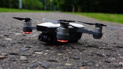
(Image provided with Lufthansa Systems news release. The new Drone Solutions app from Lufthansa Systems helps drone operators to ensure they stay safe and legal when flying their drones)

FMI: www.LHsystems.com

Advertisement

More News

ANN's Daily Aero-Linx (04.13.24)

Aero Linx: Florida Antique Biplane Association "Biplanes.....outrageous fun since 1903." That quote really defines what the Florida Antique Biplane Association (FABA) is all about.>[...]

ANN's Daily Aero-Term (04.13.24): Beyond Visual Line Of Sight (BVLOS)

Beyond Visual Line Of Sight (BVLOS) The operation of a UAS beyond the visual capability of the flight crew members (i.e., remote pilot in command [RPIC], the person manipulating th>[...]

Airborne 04.09.24: SnF24!, Piper-DeltaHawk!, Fisher Update, Junkers

Also: ForeFlight Upgrades, Cicare USA, Vittorazi Engines, EarthX We have a number of late-breaking news highlights from the 2024 Innovation Preview... which was PACKED with real ne>[...]

Aero-News: Quote of the Day (04.14.24)

“For Montaer Aircraft it is a very prudent move to incorporate such reliable institution as Ocala Aviation, with the background of decades in training experience and aviation>[...]

ANN's Daily Aero-Term (04.14.24): Maximum Authorized Altitude

Maximum Authorized Altitude A published altitude representing the maximum usable altitude or flight level for an airspace structure or route segment. It is the highest altitude on >[...]

blog comments powered by Disqus


Advertisement

Advertisement

Podcasts

Advertisement

© 2007 - 2024 Web Development & Design by Pauli Systems, LC