Five Fatally Injured When Piper Cheyenne Went Down Shortly After Takeoff
The NTSB has released its preliminary report from an accident which occurred December 28th involving a Piper PA 31T (Cheyenne) airplane which impacted terrain shortly after takeoff from the Lafayette Regional Airport/Paul Fournet Field (KLFT), Lafayette, Louisiana.
The commercial pilot and four passengers were fatally injured; one passenger sustained serious injuries. Two individuals inside a nearby building sustained minor injuries and one individual in a car sustained serious injuries. The airplane was destroyed by impact forces and a postimpact fire.
The airplane was owned by Cheyenne Partners LLC and was piloted by an employee of Global Data Systems. The personal flight was conducted under the provisions of Title 14 Code of Federal Regulations Part 91. Instrument meteorological conditions prevailed and a Federal Aviation Administration (FAA) instrument flight rules (IFR) flight plan was filed for the flight. The flight was originating at the time of the accident and was en route to the Dekalb-Peachtree Airport (KPDK), Atlanta, Georgia.
The pilot contacted the KLFT ground controller and requested a clearance to KPDK. The controller issued the IFR clearance to the pilot with an initial heading of 240° and an altitude of 2,000 ft mean sea level (msl). The controller then instructed the pilot to taxi the airplane to runway 22L. As the airplane approached the holdshort line for the runway, the pilot advised that the airplane was ready for takeoff and the controller cleared the airplane to depart from runway 22L. After takeoff the pilot was given a frequency change and successfully established communications with the next air traffic controller. The pilot was instructed to climb the airplane to 10,000 ft and to turn right to a heading of 330°.
Automatic Dependent Surveillance – Broadcast (ADS-B) data provided by the FAA identified and depicted the accident flight. The ADS-B data started at 09:20:05 as the airplane climbed through 150 ft. msl, or 110 ft. above ground level (agl). The peak altitude recorded was 925 ft msl, from about 09:20:37 to 09:20:40, after which, the airplane entered a continuous descent to the ground. The last ADS-B data point was at 09:20:59, as the airplane descended through 175 ft msl in a steep dive.
Preliminary analysis of this data indicates that after departing runway 22L, the airplane turned slightly to the right toward the assigned heading of 240° and climbed at a rate that varied between 1,000 and 1,900 feet per minute. At 09:20:13, the airplane started rolling back towards wings level. At 09:20:20, the airplane rolled through wings level in a continued roll towards the left. At this time, the airplane was tracking 232°, the altitude was 475 ft msl, and the speed accelerated through 165 kts. calibrated airspeed. The airplane continued to roll steadily to the left, at an average rate of about 2 degrees per second. At the peak altitude of 925 ft msl at 09:20:40, the roll angle was about 35° left, the track angle was about 200°, and the airspeed was about 172 knots. The airplane then started to descend while the left roll continued, and the airplane reached a roll angle of 70° left at 09:20:52, while it descended through 600 ft msl, between 2,000 and 3,000 feet per
minute.
According to the FAA, as the airplane descended through 700 ft msl, a low altitude alert was issued by the air traffic controller to the pilot; the pilot did not respond. No mayday or emergency transmission was recorded from the accident airplane.
According to multiple witnesses on the ground, they first heard an airplane flying overhead, at a low altitude. Several witnesses stated that it sounded as if both engines were at a high rpm. Multiple witnesses observed the airplane appear out of the low cloud bank in a steep, left-bank turn. One witness stated that the airplane rolled wings level just before it struck the trees and transmission lines on the south edge of Verot School Road. The airplane then struck the road and continued across the United States Postal Service (USPS) parking lot. Two USPS employees received minor injuries from flying glass inside of the building. One individual was seriously injured after the airplane struck the car she was parked in. The car rolled several times before it came to rest inverted; a postimpact fire consumed the car.
The wreckage path included fragmented and burned pieces of the airplane and tree debris, and extended from the trees and transmission line, along an approximate bearing of 315°, for 789 ft. The right wing, the outboard left wing, both engines, both elevator controls, the rudder, the instrument panel, and forward cabin separated from the main fuselage and pieces were located in the debris field. The main wreckage consisted of the main fuselage and the inboard left wing.
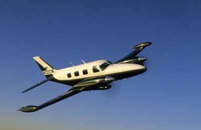
(Source: NTSB. Image from file. Not accident airplane)
 Airborne 04.16.24: RV Update, Affordable Flying Expo, Diamond Lil

