Mon, Sep 22, 2014
Says There Were Only Minimal Disruptions During Three Years Of Runway Construction
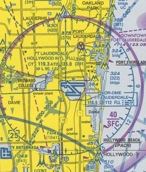
A sophisticated NextGen software tool called Time-Based Flow Management (TBFM) enabled air traffic controllers at Ft. Lauderdale-Hollywood International Airport to maintain nearly normal operations over the past three years while construction reduced the number of available runways from three to one.

TBFM, used in conjunction with existing measures such as miles-in-trail and ground delays, was the primary tool used by controllers at Ft. Lauderdale to handle 800 to 900 operations per day on what became the busiest single-operation runway in the country. Runway construction at Ft. Lauderdale is complete and a new runway officially opens tomorrow.
“NextGen is happening now in Ft. Lauderdale,” said FAA Administrator Michael Huerta. “It shows how we overcame a potentially serious limitation on capacity at Ft. Lauderdale by using a new tool in close coordination with air traffic management measures already in place.”
TBFM, which is installed throughout the country at 20 en route centers, 30 Terminal Radar Approach Control facilities and 37 towers, optimizes the flow of traffic into capacity constrained areas by scheduling aircraft to be at a certain place at a certain time. It manages the flow of arrival traffic to the TRACON, matching that flow with available airport capacity. This minimizes delays and the use of fuel-burning measures otherwise required to maintain proper distances between aircraft, such as vectoring. At Ft. Lauderdale, the tool efficiently spaced aircraft – a time-based technique known as metering – on approach to a runway at which only one aircraft could take off or land at a time. The safe and efficient metering of arriving aircraft in turn allowed controllers to smoothly clear aircraft for departure.
The success of TBFM is the result of a three-year collaborative effort involving the FAA, Ft. Lauderdale airport, airlines including jetBlue, Delta and Southwest, the National Business Aviation Association, Broward County and the National Air Traffic Controllers Association. This type of collaboration, with stakeholders involved from the outset and lines of communication kept open with frequent, regular meetings, will serve as a template for future major projects.
More News
Aero Linx: Florida Antique Biplane Association "Biplanes.....outrageous fun since 1903." That quote really defines what the Florida Antique Biplane Association (FABA) is all about.>[...]
Beyond Visual Line Of Sight (BVLOS) The operation of a UAS beyond the visual capability of the flight crew members (i.e., remote pilot in command [RPIC], the person manipulating th>[...]
Also: ForeFlight Upgrades, Cicare USA, Vittorazi Engines, EarthX We have a number of late-breaking news highlights from the 2024 Innovation Preview... which was PACKED with real ne>[...]
“For Montaer Aircraft it is a very prudent move to incorporate such reliable institution as Ocala Aviation, with the background of decades in training experience and aviation>[...]
Maximum Authorized Altitude A published altitude representing the maximum usable altitude or flight level for an airspace structure or route segment. It is the highest altitude on >[...]
 ANN's Daily Aero-Linx (04.13.24)
 ANN's Daily Aero-Term (04.13.24): Beyond Visual Line Of Sight (BVLOS)
 Airborne 04.09.24: SnF24!, Piper-DeltaHawk!, Fisher Update, Junkers
 Aero-News: Quote of the Day (04.14.24)
 ANN's Daily Aero-Term (04.14.24): Maximum Authorized Altitude


