Honeywell AV8OR ACE Enables Paperless Cockpit | Aero-News Network
Aero-News Network
RSS icon RSS feed
podcast icon MP3 podcast
Subscribe Aero-News e-mail Newsletter Subscribe

Airborne Unlimited -- Most Recent Daily Episodes

Episode Date

Airborne-Monday

Airborne-Tuesday

Airborne-Wednesday Airborne-Thursday

Airborne-Friday

Airborne On YouTube

Airborne-Unlimited-04.01.24

Airborne-Unlimited-04.09.24

Airborne-Unlimited-04.10.24 Airborne-Unlimited-04.11.24

Airborne-Unlimited-04.12.24

Join Us At 0900ET, Friday, 4/10, for the LIVE Morning Brief.
Watch It LIVE at
www.airborne-live.net

Mon, Jul 27, 2009

Honeywell AV8OR ACE Enables Paperless Cockpit

Touch Screen Handheld Priced At Less Than $2,000

Honeywell has rolled out its AV8OR ACE, a new seven-inch touch screen handheld GPS. The Bendix/King by Honeywell AV8OR ACE is being introduced at introductory pricing of $1,999 at the EAA AirVenture air show, and is now available at authorized sales and service
centers.

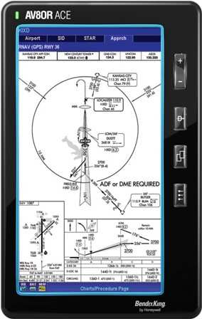
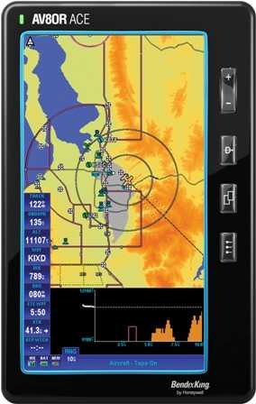
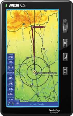
The AV8OR ACE offers a large display – seven inches – and is as easy to use as the highly touted AV8OR handheld introduced last summer, thanks to its touch screen user interface. The AV8OR ACE provides geo-referenced FAA charts, eliminating the need for general aviation pilots
to carry paper charts.

“The AV8OR ACE is able to display your airplane directly on High/Low Enroute Charts, Approach Plates and Airport Diagrams to increase situational awareness,” said Chad Cundiff, Vice President, Crew Interface Systems Marketing & Product Management at Honeywell. “AV8OR ACE customers can obtain digital charts and approach plates from Seattle Avionics Software, a leading provider of aviation software, and the unit integrates smoothly with their popular Voyager Flight Software System to ensure the safest, most efficient route. Over time, we expect to provide our customers with additional charting options.”


“We’re very excited to provide our exclusive seamless IFR charts to the AV8OR ACE,” said Steve Podradchik, CEO of Seattle Avionics. “With these  charts, pilots can fly from one end of the country to the other with what looks like one country-sized Low Altitude or High Altitude chart.
Pilots don’t have to flip charts as they fly, significantly increasing ease of use and safety. Both Honeywell and Seattle Avionics Software are working to make flying easier, safer, more fun and affordable.”

“We’ve been providing pilots with affordable avionics for safer flight in general aviation for 50 years,” added Cundiff.

The AV8OR ACE includes all of the same capability found in the AV8OR handheld, including a Wide Area Augmentation System (WAAS) GPS, automotive navigation, regional databases, airport information services including fuel pricing and interfaces for traffic and weather. The airport services data is from Flight Guide, the industry standard in general aviation for almost 50 years. The weather interface supports WxWorx, one of the nation’s largest XM Satellite Weather data providers.

The AV8OR family includes a range of handheld products for any pilot, flight, or budget, from the AV8OR to the AV8OR Vision 3D, available later this year. Introduced last year, the AV8OR Horizon 3D provides synthetic vision in a touch screen electronic flight bag for less than $5,000.

FMI: www.bendixking.com/AV8OR

Advertisement

More News

ANN's Daily Aero-Linx (04.13.24)

Aero Linx: Florida Antique Biplane Association "Biplanes.....outrageous fun since 1903." That quote really defines what the Florida Antique Biplane Association (FABA) is all about.>[...]

ANN's Daily Aero-Term (04.13.24): Beyond Visual Line Of Sight (BVLOS)

Beyond Visual Line Of Sight (BVLOS) The operation of a UAS beyond the visual capability of the flight crew members (i.e., remote pilot in command [RPIC], the person manipulating th>[...]

Airborne 04.09.24: SnF24!, Piper-DeltaHawk!, Fisher Update, Junkers

Also: ForeFlight Upgrades, Cicare USA, Vittorazi Engines, EarthX We have a number of late-breaking news highlights from the 2024 Innovation Preview... which was PACKED with real ne>[...]

Aero-News: Quote of the Day (04.14.24)

“For Montaer Aircraft it is a very prudent move to incorporate such reliable institution as Ocala Aviation, with the background of decades in training experience and aviation>[...]

ANN's Daily Aero-Term (04.14.24): Maximum Authorized Altitude

Maximum Authorized Altitude A published altitude representing the maximum usable altitude or flight level for an airspace structure or route segment. It is the highest altitude on >[...]

blog comments powered by Disqus


Advertisement

Advertisement

Podcasts

Advertisement

© 2007 - 2024 Web Development & Design by Pauli Systems, LC