Locata's Centimeter-Level Positioning To Be Installed At White Sands Missile Range
The U.S. Air Force has signed a sole-source, multi-year, multi-million dollar contract to install the U.S. Military's first ground-based LocataNet positioning system at the famed White Sands Missile Range in New Mexico. The USAF will field new technology developed by the Australian company Locata to provide them with extremely accurate "reference truth" positioning across a vast area of White Sands when GPS is being completely jammed.
In a recent USAF technical report the need for a new non-GPS based positioning capability was described by the 746th Test Squadron (746TS) as the key component for "the realization of the new 'gold standard truth system' for the increasingly demanding test and evaluation of future navigation systems for the U.S. Department of Defense." Locata is the new technology now contracted to enable this "gold standard capability" for the USAF's future truth reference, the Ultra High-Accuracy Reference System (UHARS).
The report documented extensive testing of Locata's new capabilities when a LocataNet covering 1,350 square miles was first deployed at White Sands. The USAF and 746TS proved a LocataNet can accurately position USAF aircraft over a large area when GPS is "denied." In fact, Locata delivered superbly accurate independent positioning which was as good as, or better than, the USAF's current CIGTF Reference System (CRS). The CRS is arguably the most accurate reference system available for flight and ground testing today. It's an extremely sophisticated hi-tech system, combining a differential dual-frequency GPS solution and a high accuracy inertial measurement unit with integrated gravity deflection of vertical corrections. The CRS is the system which has provided reference in support of a plethora of high-accuracy navigation tests for the USAF over the last decade. The Locata non-GPS based positioning capability is core to the UHARS which will now replace the CRS in 2014.
"Locata delivered a LocataNet for use in our October 2011 technical demonstration on White Sands Missile Range that provided time and position truth, independent of GPS, that was better than 6 inches per axis while flying at 15,000 and 20,000 feet above mean sea level profiles," said Christopher Morin, Technical Director for the 746TS. "The solutions provided by the LocataNet were within the accuracy tolerance of the squadron's CIGTF Reference System and met our threshold objectives. Further analysis has shown that if we optimize the LocataNet deployment, characterize its errors and tightly couple its range and carrier-phase measurements with the other GPS and inertial components on the UHARS pallet into the UHARS solution post-processing software, I am confident we will be able to meet our 5 cm (2 inch) per axis truth reference objective. I am very pleased with the LocataNet's demonstrated ability to produce an accurate, dynamic truth reference from the relatively static implementation they had
already deployed in the mining industry."
"Locata products developed and sold by important commercial partners like Hexagon and Leica Geosystems have already shown our new technology is a game-changer for positioning over industrial-sized areas," said Nunzio Gambale, CEO and co-founder of Locata. "However, proving Locata can provide the USAF with cm-accurate non-GPS positioning over a vast military area when GPS is jammed instantly elevates our technology achievements into a completely new league. It's important to grasp the scale of what we've done here. The 2,500 square mile LocataNet at White Sands will be 74 times the size of Manhattan Island. It must be clear, our ability to deliver cm-level (inch-level) positioning over an area that large, without using GPS satellites, is both unique and totally revolutionary! No-one else on earth can do this. Many valuable industrial and consumer apps will now be built around our amazing inventions, created by Locata's co-founder David Small and our brilliant engineers."
"This contract makes it clear you are witnessing the arrival of one of the most important technology developments for the future of the entire positioning industry," added Gambale.
Under this new contract, Locata will provide the USAF with Locata Receivers and LocataLite transmitters to blanket 2,500 square miles of the White Sands Range. Locata will also:
- Deliver extended hardware warranty, along with ongoing Locata software and firmware upgrades, through to the year 2025.
- Supply multi-year support for the installation, fielding and testing of Locata networks.
- Provide long-term consultation and expert technical advice to ensure optimal operational performance of the USAF's fielded LocataNet systems.
Prof. Chris Rizos, Head of the UNSW School of Surveying and Geospatial Engineering and Chair of the Working Group that developed the Australian Strategic Plan for Global Navigation Satellite Systems said the demand for an accurate, reliable and repeatable positioning capability in all environments and at all times grows stronger daily. "However," he said, "it is clear that satellite-based systems alone cannot meet positioning expectations for future applications in machine automation, robotics, mining, heavily wooded or rugged terrain, urban and indoor environments, as well as where there is intentional (or unintentional) GPS interference such as at White Sands. It is becoming critically important for the world to have a real, locally controlled 'GPS back-up' that addresses obvious GPS vulnerabilities. Locata must now be factored into any analysis of a viable alternative, or future augmentation, to GPS."
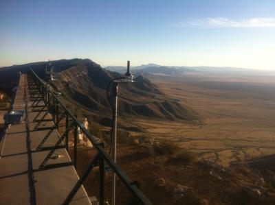
(Image provided by Locata)
 ANN's Daily Aero-Linx (04.15.24)

