All 11 People On Board Were Fatally Injured, Company Was Not Authorized To Offer Skydiving Tours
The NTSB has released its preliminary report from an accident which occurred June 21 at Dillingham Airfield (HDH), Mokuleia, Hawaii. The commercial pilot and ten passengers sustained fatal injuries, and the airplane was destroyed.
The Beech Queen Air, which was owned by N80896 LLC and was being operated by Oahu Parachute Center (OPC), collided with terrain after takeoff from HDH.
According to the report, the owner of OPC said the accident flight was the fourth of five parachute jump flights scheduled for that day. Two flights took place between 0900 and 0930 and the third departed about 1730 on the first of what OPC called, "sunset" flights. The occupants on the accident flight included the pilot, three tandem parachute instructors and their three customers, and two camera operators; two solo jumpers decided to join the accident flight at the last minute.
The passengers were loaded onto the airplane while it was on the taxiway next to the OPC facility on the southeast side of the airport. A parachute instructor at OPC observed the boarding process and watched as the airplane taxied west to the departure end of runway 8. He could hear the engines during the initial ground roll and stated that the sound was normal, consistent with the engines operating at high power. When the airplane came into his view as it headed toward him, it was at an altitude of between 150 and 200 ft above ground level and appeared to be turning. He could see its belly, with the top of the cabin facing the ocean to the north. The airplane then struck the ground in a nose-down attitude, and a fireball erupted.
The final second of the accident sequence was captured in the top left frame of a surveillance video camera located at the southeast corner of the airport. Preliminary review of the video data revealed that just before impact the airplane was in an inverted 45° nose-down attitude.
Runway 8/26 at Dillingham Airfield is a 9,007-ft-long by 75-ft-wide asphalt runway, with displaced thresholds of 1,993 ft and 1,995 ft, respectively. A parachute landing area was located beyond the departure end of runway 8, and the standard takeoff procedure required a left turn over the adjacent beach to avoid that landing zone. The displaced threshold areas had been designated for sailplane and towplane use, with powered aircraft advised to maintain close base leg turns to assure separation.
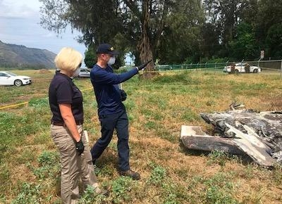
The airplane came to rest inverted on a heading of about 011° magnetic, 500 ft north of the runway centerline, and 5,550 ft beyond the runway 8 numbers, where the takeoff roll began. The debris field was confined to a 75-ft-wide area just inside the airport perimeter fence. The cabin, tail section, and inboard wings were largely consumed by fire, and both wings outboard of the engine nacelle sustained leading edge crush damage and thermal exposure. Both engines came to rest in the center of the debris field, and fragments of the vertical and both horizontal stabilizers were located within the surrounding area.
The U.K. newspaper The Daily Mail reports that, according to the Hawaii Department of Commerce and Consumer Affairs, the company was "not in good standing" with the state and was not a registered tenant for the state-owned land it occupied at the airport. It had initially been granted a permit under the name Hawaii Parachute Center for parachute repairs and rigging in 2010, but was not approved for skydiving operations. The Oahu Parachute Center was registered with the state in 2017, but was never granted a permit for skydiving tours.
The state had sent a cease and desist letter to the company on April 16, setting a May 16 deadline to produce tax records. Two weeks before the accident, the state sent a permit application to OPC for skydiving operations to owner George Rivera. The application gave Rivera 30 days to produce required documents including tax records for the county and state and other paperwork. The application had not been filed at the time of the accident, according to the report.
William Garcia, the owner of N80896 LLC which is based in California, confirmed to The Daily Mail that it owned the airplane, which had been involved in a skydiving accident in that state in 2016. It was restored to airworthy condition and shipped to Hawaii.
(Accident image provided by the NTSB. Aircraft image from file, not accident airplane)
 ANN's Daily Aero-Linx (04.13.24)

