NOAA's Next Generation Geostationary Satellite Program Successfully Reviewed | Aero-News Network
Aero-News Network
RSS icon RSS feed
podcast icon MP3 podcast
Subscribe Aero-News e-mail Newsletter Subscribe

Airborne Unlimited -- Most Recent Daily Episodes

Episode Date

Airborne-Monday

Airborne-Tuesday

Airborne-Wednesday Airborne-Thursday

Airborne-Friday

Airborne On YouTube

Airborne-Unlimited-04.01.24

Airborne-Unlimited-04.09.24

Airborne-Unlimited-04.10.24 Airborne-Unlimited-04.11.24

Airborne-Unlimited-04.12.24

Join Us At 0900ET, Friday, 4/10, for the LIVE Morning Brief.
Watch It LIVE at
www.airborne-live.net

Fri, Nov 30, 2012

NOAA's Next Generation Geostationary Satellite Program Successfully Reviewed

External Audit Of Weather Satellite Program Moves New Spacecraft Closer To 2015 Launch

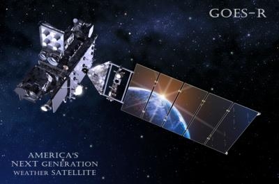
The GOES-R Series Program, which is leading the effort to replace and upgrade NOAA’s existing fleet of geostationary satellites that track severe weather across the United States, received a favorable appraisal conducted by an external team of aerospace experts of its preparations to launch the new series, beginning in late 2015.

“Severe weather was again a major story in America this year,” said Mary Kicza, assistant administrator of NOAA’s Satellite and Information Service. “Passing this Mission Critical Design Review gives us confidence that the GOES-R Program’s development is progressing well and will be ready to carry the latest technology to help improve NOAA’s weather forecasts.” 

At all times, NOAA operates two Geostationary Operational Environmental Satellites from a fixed position, 22,300 miles above the Earth. Additionally, NOAA keeps one GOES in orbital storage mode, ready to step in if one of the active satellites experiences trouble. NOAA’s geostationary satellites constantly monitor all weather conditions, from tornadoes, floods and snowstorms, to wildfires and developing tropical storms. In addition to their weather duties, GOES satellites also monitor solar activity, relay a wide variety of environmental data from earth-based observing systems, and detect emergency beacon signals from persons in distress. 

NOAA’s GOES-13, which is the GOES East satellite, proved its mettle when Sandy threatened the Caribbean and the U.S., sending more than 1,200 images of the storm to NOAA forecasters, from October 20-31, as it approached -- and then impacted -- the Eastern seaboard. NOAA manages the GOES-R Series Program through an integrated NOAA-NASA program office, staffed with personnel from NOAA and NASA, and co-located at NASA’s Goddard Space Flight Center in Greenbelt, MD. 

The GOES-R satellites are expected to more than double the clarity of today’s GOES imagery and provide more atmospheric observations than current capabilities with more frequent images. Data from the GOES-R instruments will be used to create many different products that will help NOAA meteorologists and other users monitor the atmosphere, land, ocean and the sun.  GOES-R will also carry a new Geostationary Lightning Mapper that will provide for the first time a continuous surveillance of total lightning activity throughout the Americas and adjacent oceans.  

“We’re just a few years away from seeing significant improvements in the way NOAA will serve the public with better weather forecasts and warnings,” said Greg Mandt, director of the GOES-R Series Program. “That’s something everyone should be excited about.”

NOAA’s mission is to understand and predict changes in the Earth’s environment, from the depths of the ocean to the surface of the sun and to conserve and manage our coastal and marine resources.

(Image provided by NOAA)

www.noaa.gov

Advertisement

More News

ANN's Daily Aero-Linx (04.13.24)

Aero Linx: Florida Antique Biplane Association "Biplanes.....outrageous fun since 1903." That quote really defines what the Florida Antique Biplane Association (FABA) is all about.>[...]

ANN's Daily Aero-Term (04.13.24): Beyond Visual Line Of Sight (BVLOS)

Beyond Visual Line Of Sight (BVLOS) The operation of a UAS beyond the visual capability of the flight crew members (i.e., remote pilot in command [RPIC], the person manipulating th>[...]

Airborne 04.09.24: SnF24!, Piper-DeltaHawk!, Fisher Update, Junkers

Also: ForeFlight Upgrades, Cicare USA, Vittorazi Engines, EarthX We have a number of late-breaking news highlights from the 2024 Innovation Preview... which was PACKED with real ne>[...]

Aero-News: Quote of the Day (04.14.24)

“For Montaer Aircraft it is a very prudent move to incorporate such reliable institution as Ocala Aviation, with the background of decades in training experience and aviation>[...]

ANN's Daily Aero-Term (04.14.24): Maximum Authorized Altitude

Maximum Authorized Altitude A published altitude representing the maximum usable altitude or flight level for an airspace structure or route segment. It is the highest altitude on >[...]

blog comments powered by Disqus


Advertisement

Advertisement

Podcasts

Advertisement

© 2007 - 2024 Web Development & Design by Pauli Systems, LC