Texas CAP Wing Launches Photo Flights Along Gulf Coast | Aero-News Network
Aero-News Network
RSS icon RSS feed
podcast icon MP3 podcast
Subscribe Aero-News e-mail Newsletter Subscribe

Airborne Unlimited -- Most Recent Daily Episodes

Episode Date

Airborne-Monday

Airborne-Tuesday

Airborne-Wednesday Airborne-Thursday

Airborne-Friday

Airborne On YouTube

Airborne-Unlimited-04.01.24

Airborne-Unlimited-04.16.24

Airborne-FlightTraining-04.17.24 Airborne-Unlimited-04.11.24

Airborne-Unlimited-04.12.24

Join Us At 0900ET, Friday, 4/10, for the LIVE Morning Brief.
Watch It LIVE at
www.airborne-live.net

Tue, Sep 16, 2008

Texas CAP Wing Launches Photo Flights Along Gulf Coast

Recon Missions Assist In Rescue Efforts

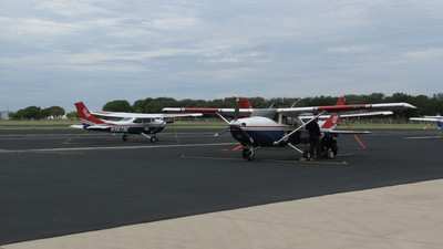
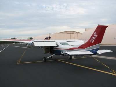
Members of Civil Air Patrol’s Texas Wing launched dozens of flights Monday to take photographs of damage in Houston, Galveston and other parts of east Texas, after Hurricane Ike devastated the state when it made landfall early Saturday.

The Federal Emergency Management Agency, 1st Air Force and the state of Texas all requested CAP’s assistance after Ike forced hundreds of thousands of residents to evacuate and knocked out power to millions of homes and businesses.

Wing Commander Col. Joe Smith said eight aircraft launched up to 40 flights today from CAP’s base in San Antonio. CAP’s state-of-the-art ARCHER (airborne real-time cueing hyperspectral enhanced reconnaissance) technology was used to geolocate contaminants in the state’s groundwater.

CAP members throughout Texas gathered to help fellow citizens recover from the disaster that flooded and blocked roads with debris and left thousands uncertain of meeting immediate needs for food and shelter. Smith said although CAP members were among those devastated by the hurricane, they still came forth to assist.

"Everybody’s pitching in saying, 'What can I do to help?' Ground team members also passed out bottled water to residents in Houston at a FEMA distribution site," he said. "CAP’s aerial damage assessment photographs are vital to state and federal emergency managers’ ability to readily assess the extent of damage to the state’s infrastructure, including roads, bridges and power lines, as well as selected buildings."

"The state of Texas really appreciates our photo capabilities. Local, state and federal officials appreciate our efforts," Smith added. "They can go to a University of Texas Web site where we upload our photos, select their county and see pictures of damage in their hometowns."  

CAP received an additional tasking from FEMA today to take aerial damage assessment photos in both Texas and Louisiana of key ferry landings, bridges and plants. CAP expects these taskings to continue throughout the week.

Civil Air Patrol, the official auxiliary of the US Air Force, is a nonprofit organization with more than 56,000 members nationwide. CAP performs 90 percent of continental US inland search and rescue missions as tasked by the Air Force Rescue Coordination Center and was credited by the AFRCC with saving 103 lives in fiscal year 2007.

FMI: www.cap.gov

Advertisement

More News

ANN's Daily Aero-Linx (04.15.24)

Aero Linx: International Flying Farmers IFF is a not-for-profit organization started in 1944 by farmers who were also private pilots. We have members all across the United States a>[...]

Classic Aero-TV: 'No Other Options' -- The Israeli Air Force's Danny Shapira

From 2017 (YouTube Version): Remembrances Of An Israeli Air Force Test Pilot Early in 2016, ANN contributor Maxine Scheer traveled to Israel, where she had the opportunity to sit d>[...]

Aero-News: Quote of the Day (04.15.24)

"We renegotiated what our debt restructuring is on a lot of our debts, mostly with the family. Those debts are going to be converted into equity..." Source: Excerpts from a short v>[...]

Airborne 04.16.24: RV Update, Affordable Flying Expo, Diamond Lil

Also: B-29 Superfortress Reunion, FAA Wants Controllers, Spirit Airlines Pulls Back, Gogo Galileo Van's Aircraft posted a short video recapping the goings-on around their reorganiz>[...]

ANN's Daily Aero-Term (04.16.24): Chart Supplement US

Chart Supplement US A flight information publication designed for use with appropriate IFR or VFR charts which contains data on all airports, seaplane bases, and heliports open to >[...]

blog comments powered by Disqus


Advertisement

Advertisement

Podcasts

Advertisement

© 2007 - 2024 Web Development & Design by Pauli Systems, LC