Flight Was In Introductory Lesson For A New Student
The NTSB has released a factual report for an an accident which occurred in California involving an American Aviation AA-1A under VFR conditions. The instructor held a Commercial certificate with an instrument rating ... at just 18 years of age. A witness to the accident said she saw the airplane performing turns that bordered on "aerobatic" before going down. There was a post-impact fire, and neither occupant of the aircraft survived the accident.

HISTORY OF FLIGHT
On July 23, 2011, at 1023 Pacific daylight time, an American Aviation AA-1A, N34299, collided with mountainous terrain near Corona, California. The pilot was operating the airplane under the provisions of Title 14 Code of Federal Regulations Part 91. The certified flight instructor (CFI) and student pilot sustained fatal injuries. The airplane sustained substantial damaged during the accident sequence, and was subsequently consumed by post impact fire. The local instructional flight departed Chino Airport, Chino, California, at 1015. Visual meteorological conditions prevailed, and no flight plan had been filed.
The CFI recently became an instructor for Duke's Flying Club (DFC). According to the Manager of DFC, the flight was an introductory lesson for the student pilot, with a destination of Lake Matthews, located about 15 miles southeast of Chino. He stated that the CFI had joined DFC in June 2011, and that this was his second flight with the club as an instructor.
A witness, located in her bedroom on the north side of her residence about 600 feet northeast of the accident site, was talking on the telephone when she heard an aircraft fly overhead. She stated that aircraft often fly in the area, but this sound was much louder, and appeared lower than usual. She became concerned, and ran outside to look for the aircraft. She looked to the west, towards the foothills, and observed an airplane flying from right to left just above the ridgeline. The airplane then made an abrupt, swooping, and descending left turn towards her position. She described the turn as extravagant, and similar to an aerobatic maneuver typically seen at air shows. As the airplane began to roll out of the turn, the wings started to rock from side to side. The airplane then immediately descended, nose-down into the ground. She stated that throughout the flight, including the descent, the airplane did not appear to be trailing smoke or vapors, and that the engine was producing a sound consistent
with high power. She reported weather at the time of the accident to be calm winds and clear skies.
The FAA provided radar and air traffic control audio data for the flight. The data revealed a target displaying a 1200 beacon code, and no altitude information, on a southeast track, departing Chino Airport airspace at 1018. The target continued on the same track for the next 2 minutes, traveling directly over Corona Municipal Airport. At 1023, the target began a left turn followed by a right turn, returning to a southbound track 50 seconds later. The target continued south for another minute. For the next 10 seconds, the target began a 50-degree turn to the left, followed 5 seconds later by a 90-degree right turn towards mountainous terrain. The wreckage was located about 200 feet east of this final radar return.
The audio data revealed that air traffic control personnel from Chino Tower were able to locate the airplane's primary radar target just after departure, but the target did not appear to be transmitting altitude information. During multiple radio communication exchanges, the pilot reported cycling the transponder, and ultimately switching it to non-altitude reporting mode. Tower personnel subsequently provided traffic advisories, and approved the pilot to change radio frequencies. During the exchange, the pilot reported that he was climbing through 1,800 feet to 2,500 feet. The last recorder transmission made by the pilot occurred about 5 minutes after takeoff, when he inadvertently transmitted his position to Corona Airport traffic utilizing the Chino Airport radio frequency.
PERSONNEL INFORMATION
CFI
The pilot’s flight records were not recovered, and assumed to have been destroyed by the post impact fire.
A review of FAA airman records revealed that the 18-year-old pilot was first issued a private pilot certificate with a glider rating in November 2008. He progressed to a commercial pilot certificate with ratings for airplane single-engine land, and instrument airplane, on January 24, 2011. On March 21, 2011, he was issued his CFI certificate, with ratings for airplane single-engine land.
According to his Airman Certificate/Rating applications, he had accrued a total of 301.2 hours flight experience at the time of the application for his commercial certificate, and 350 hours at the time of his application for a CFI certificate.
According to acquaintances of the pilot, all of his glider flight experience was in Civil Air Patrol aircraft. His experience with the Grumman AA-1A series of aircraft was limited to the prior instructional flight for DFC, and an introductory flight with the manager.
All of the pilot’s powered airplane check rides were conducted by the same FAA examiner.
The pilot held a first-class medical certificate issued on July 15, 2010. It had no limitations or waivers.
Student Pilot
A review of FAA airman records revealed that the 19-year-old pilot did not hold a combined student pilot/medical certificate, or any other rating. FAA regulations do not require that a pilot hold such a certificate during dual flight training.
AIRPLANE INFORMATION
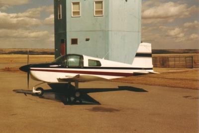
The low-wing, two-seat airplane, serial number AA1A-0270, was manufactured in 1971. It was powered by a four-cylinder Lycoming O-235-C2C engine, serial number L-10639-15, and equipped with a fixed pitch McCauley metal propeller. (Similar airplane pictured. Not accident aircraft)
A review of airframe and engine maintenance logbooks revealed that the airplane had undergone an annual inspection, which was completed the day prior to the accident. At that time, the airplane had accrued a total of 6,545.02 flight hours, with the engine accumulating a total of 1,652.32 hours since its overhaul in 2003.
METEOROLOGICAL
An automated surface weather observation at Corona Airport (elevation 533 feet msl, 5 miles northwest of the accident site) was issued 27 minutes prior to the accident. It indicated variable wind at 3 knots; 5 miles visibility in haze, with clear skies; temperature of 21 degrees C; dew point 14 degrees C; and an altimeter setting at 29.95 inches of mercury.
WRECKAGE AND IMPACT INFORMATION
The airplane wreckage was located in the foothills adjacent to the northern region of the Cleveland National Forest, about 10 miles south-southeast of Chino Airport, and 7 miles west of Lake Matthews. The accident site was on a 15-degree northeast-facing slope, at the 1,500-foot level. The terrain was comprised of waist-high scrub brush, interspersed with trees ranging in height from 10-30 feet.
From the wreckage location, the terrain rose to the 4,007-foot peak of Mount Pleasant, located about 2.5 miles to the west. The mountain range continued further 8 miles southeast, where it reached a maximum elevation of 5,720 feet at Santiago Peak.
The first identified point of impact consisted of a ground disruption in soft dirt, which contained the propeller, a section of engine cowling, and fragments of the engine flywheel, canopy frame, and clear Plexiglas. Both propeller blades sustained chordwise scoring, and remained attached to the hub. The composite propeller spinner was fragmented, with the spinner plate formed around the front and rear surfaces of both blades opposite the direction of rotation. One blade was curled aft, about 90 degrees from the root. The second blade sustained about 15 degrees of tip twist.
The engine and nose landing gear structure was separated from the fuselage, and located about 20 feet downhill from the propeller.
The main wreckage was located 15 feet downhill, and consisted of the primary fuselage structure, tail section, and both wings. The entire structure was thermally destroyed, with only partial ash remnants of the wings, control surfaces, and fuselage structure remaining. Both wing spars came to rest on an east-west heading, and remained partially attached to the landing gear struts, and cabin seats. Burnt remnants of the cabin controls, tailcone, and empennage were located underneath the wing spar center section. The rudder control cable was continuous from the rudder horns, through to the foot pedals.
The remaining wreckage consisted of fragmented and dispersed sections of the control yokes, foot pedals, and flight instruments, all of which remained within the immediate vicinity of the accident site.
No impact damage or witness marks were noted to any of the trees surrounding the wreckage area. The ensuing post-accident fire burned about 1 acre of land, to the northwest of the accident site.
MEDICAL AND PATHOLOGICAL INFORMATION
The County of Riverside Sheriff-Coroner conducted a postmortem examination of both pilots. The cause of death was reported as the effect of multiple blunt force traumatic injuries.
Toxicological specimens from the pilots were recovered by the Coroner, and tested by the FAA Civil Aerospace Medical Institute (CAMI). Analysis revealed no findings for carbon monoxide, or cyanide for the CFI, with negative results for all screened drug substances and ingested alcohol. Analysis of samples collected from the student pilot revealed similar negative findings for cyanide and ingested alcohol, with 2.711 (ug/ml, ug/g) Acetaminophen detected in blood. The specimens recovered were unsuitable for carbon monoxide analysis.
According to CAMI, Acetaminophen, a common over the counter analgesic/antipyretic, has a therapeutic low and high of 5.0 and 50.0 ug/ml, respectively.
Refer to the toxicology report included in the docket for specific test parameters and results.
TESTS AND RESEARCH
Engine
The airplane was examined subsequent to the removal of the wreckage. The engine sustained extensive thermal damage, and all ancillary hoses, cables, and lines were destroyed. The aft sections of both magnetos and the carburetor bowl had melted. The forward engine case was bent, impinging the crankshaft at the forward bearing. The propeller crankshaft flange remained attached, with a section of its plate surface torn aft and away from the crankshaft. The top spark plugs were removed, and exhibited black sooting consistent with postaccident thermal damage. Plugs one, two, and three exhibited wear signatures consistent with normal operation when compared to the Champion AV-27 check-a-plug chart. Plug three exhibited worn out - normal signatures.
The engine cylinder heads were examined through the spark plug holes utilizing a borescope. The piston crowns and valves all exhibited grey deposits with black sooting. No valve-to-piston head piston contact, or other mechanical damage, was observed. Damage to the forward crankshaft and engine casing precluded rotation of the engine's drive train. Removal of the rocker covers revealed all springs and rockers to be oil wet.
No evidence of preimpact mechanical malfunction was noted during the examination of the recovered engine, a detailed engine report is contained within the public docket.
ADDITIONAL INFORMATION
Radar data indicated that the airplane's groundspeed as it approached the final turn was about 96 knots, reducing to 77 knots during the turn, the radius of which was about 400 feet. Referencing Aerodynamics for Naval Aviators (NAVWEPS 00-80T-80), Figure 2.29, General Turning Performance (Constant Altitude, Steady Turn), the airplane's angle of bank would have been between 50 and 60 degrees.
According to the Flight Manual, applicable to this series of airplane, the stall speed at a bank angle of 60 degrees, maximum gross weight, and forward center of gravity loading, was 79 knots calibrated airspeed with the flaps up, and 75 knots with the flaps down. The airplane's flap position at the time of the accident could not be determined.
The manual further states, "Avoid uncoordinated use of the controls at the stalling speed as this may result in s spin. SPINS ARE PROHIBITED...There is evidence that permitting a spin to go beyond one turn without initiating proper recovery procedures can allow a spin mode to develop from which recovery is not possible."
 ANN's Daily Aero-Linx (04.13.24)

