Lockheed Martin Demonstrates 'Airspace Deconfliction' Of Multiple UAVs | Aero-News Network
Aero-News Network
RSS icon RSS feed
podcast icon MP3 podcast
Subscribe Aero-News e-mail Newsletter Subscribe

Airborne Unlimited -- Most Recent Daily Episodes

Episode Date

Airborne-Monday

Airborne-Tuesday

Airborne-Wednesday Airborne-Thursday

Airborne-Friday

Airborne On YouTube

Airborne-Unlimited-04.01.24

Airborne-Unlimited-04.16.24

Airborne-FlightTraining-04.17.24 Airborne-Unlimited-04.11.24

Airborne-Unlimited-04.12.24

Join Us At 0900ET, Friday, 4/10, for the LIVE Morning Brief.
Watch It LIVE at
www.airborne-live.net

Tue, Aug 26, 2008

Lockheed Martin Demonstrates 'Airspace Deconfliction' Of Multiple UAVs

Advanced Sensors, 'See And Avoid' Characteristics Able To Avoid Collisions

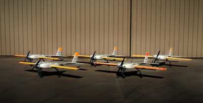
Lockheed Martin's Unmanned Aerial Vehicle Airspace Management System (UAMS) solved one of the more difficult challenges facing military services and their industry partners by successfully demonstrating the ability to deconflict groups of in-flight UAVs during a test near Pittsburgh, PA.

Sponsored by the Army's Aviation Applied Technology Directorate, a team lead by Lockheed Martin Advanced Technology Laboratories (ATL) developed UAMS as a battalion echelon system that deconflicts flight paths of multiple, small UAVs with limited on-board sensors, communications and processing resources. UAMS also uses its own on-board sensors to "see-and-avoid" obstacles and other aircraft.

"The successful use of UAMS on in-flight UAVs caps three years of program development," said David Van Brackle, ATL's UAMS project manager. "Our work will improve safety and mission success for future UAV systems and for the Warfighters who depend upon them."

UAMS uses a ground-based airspace manager and UAV-based intelligent software agents to distribute the problem of airspace management. The system separates deconfliction into three activities: maintaining situational awareness and common, relevant operating picture; detecting conflict; and modifying flights paths. UAMS performs these activities on a centralized server or distributes them to the UAVs for deconfliction. It can also use a combination of both techniques, dynamically shifting among the three performance approaches based on the situation, user-defined policies based on terrain, communications load, server load, and other factors.

UAMS also uses sensor input to detect and react to obstacles, giving the UAV a "see-and-avoid" capability, allowing the UAV to react quickly while UAMS deconflicts the new path with other UAVs.

Lockheed says UAMS works over a range of operational environments, from large rolling terrain to smaller urban airspaces.

For the program, ATL developed the distributed vehicle-information-management technology, concept of operations, and systems engineering. Teammate SRI provided avoidance-planning algorithms, and teammate SkEyes provided key avoidance sensor capabilities, including forward-looking, conic, laser radar and acoustic sensors.

FMI: www.lockheedmartin.com/

Advertisement

More News

ANN's Daily Aero-Linx (04.15.24)

Aero Linx: International Flying Farmers IFF is a not-for-profit organization started in 1944 by farmers who were also private pilots. We have members all across the United States a>[...]

Classic Aero-TV: 'No Other Options' -- The Israeli Air Force's Danny Shapira

From 2017 (YouTube Version): Remembrances Of An Israeli Air Force Test Pilot Early in 2016, ANN contributor Maxine Scheer traveled to Israel, where she had the opportunity to sit d>[...]

Aero-News: Quote of the Day (04.15.24)

"We renegotiated what our debt restructuring is on a lot of our debts, mostly with the family. Those debts are going to be converted into equity..." Source: Excerpts from a short v>[...]

Airborne 04.16.24: RV Update, Affordable Flying Expo, Diamond Lil

Also: B-29 Superfortress Reunion, FAA Wants Controllers, Spirit Airlines Pulls Back, Gogo Galileo Van's Aircraft posted a short video recapping the goings-on around their reorganiz>[...]

ANN's Daily Aero-Term (04.16.24): Chart Supplement US

Chart Supplement US A flight information publication designed for use with appropriate IFR or VFR charts which contains data on all airports, seaplane bases, and heliports open to >[...]

blog comments powered by Disqus


Advertisement

Advertisement

Podcasts

Advertisement

© 2007 - 2024 Web Development & Design by Pauli Systems, LC