FAA Exceeds 3,000 WAAS LPV Approaches | Aero-News Network
Aero-News Network
RSS icon RSS feed
podcast icon MP3 podcast
Subscribe Aero-News e-mail Newsletter Subscribe

Airborne Unlimited -- Most Recent Daily Episodes

Episode Date

Airborne-Monday

Airborne-Tuesday

Airborne-Wednesday Airborne-Thursday

Airborne-Friday

Airborne On YouTube

Airborne-Unlimited-04.01.24

Airborne-Unlimited-04.09.24

Airborne-Unlimited-04.10.24 Airborne-Unlimited-04.11.24

Airborne-Unlimited-04.12.24

Join Us At 0900ET, Friday, 4/10, for the LIVE Morning Brief.
Watch It LIVE at
www.airborne-live.net

Mon, Dec 24, 2012

FAA Exceeds 3,000 WAAS LPV Approaches

More Than 1,500 Airports Have Published Precision Approaches

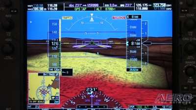
Pilots flying all types of aircraft are now able to reach more runways in low visibility conditions than ever before.  The FAA says that last month, the Wide Area Augmentation System (WAAS) program exceeded 3,000 Localizer Performance with Vertical guidance (LPVs) approaches published. This is significant because of the safety and capacity benefits of WAAS-enabled approaches.

WAAS now provides vertically-guided approach capability at more than 1,500 airports, bringing aircraft to as low as 200 feet above the runway surface. Some airports do not qualify for LPVs because of obstructions or terrain. In those cases, the FAA is providing WAAS Localizer Performance (LP) procedures.

WAAS makes it possible for pilots to use GPS from takeoff through the equivalent of a Category I Instrument Landing Systems (ILS) approach. More than 60,000 aircraft are certified to use WAAS, which means they are capable of using Performance Based Navigation (PBN), a key component for the FAA’s Next Generation Air Transportation System (NextGen). The use of PBN frees aircraft from the old highways in the sky that are dependent on ground-based beacons, allowing for more direct and fuel-efficient routes.  It also provides options for avoiding bad weather or unexpected air traffic congestion.

Since becoming operational in 2003, WAAS has made remarkable progress. With the consistent development of LPVs and LPs, WAAS will continue to enhance safety and enable pilots to fly into places that would have been unavailable nine years ago.

The WAAS program reached another major milestone this year when the FAA awarded the WAAS Geostationary Earth Orbit GEO Satellite Service Lease contract to Raytheon Company of Fullerton, Calif. Geostationary satellites provide better broadcast coverage throughout the United States.

WAAS uses three GEO satellites to broadcast the WAAS signal to users across North America. Three satellites are required to maintain WAAS availability. The current GEO satellite leased services expire between 2015 and 2017.  These new WAAS GEO satellites will enable the FAA to sustain the WAAS GEO satellite constellation maintaining high availability of service to users.

FMI: www.faa.gov

Advertisement

More News

ANN's Daily Aero-Linx (04.13.24)

Aero Linx: Florida Antique Biplane Association "Biplanes.....outrageous fun since 1903." That quote really defines what the Florida Antique Biplane Association (FABA) is all about.>[...]

ANN's Daily Aero-Term (04.13.24): Beyond Visual Line Of Sight (BVLOS)

Beyond Visual Line Of Sight (BVLOS) The operation of a UAS beyond the visual capability of the flight crew members (i.e., remote pilot in command [RPIC], the person manipulating th>[...]

Airborne 04.09.24: SnF24!, Piper-DeltaHawk!, Fisher Update, Junkers

Also: ForeFlight Upgrades, Cicare USA, Vittorazi Engines, EarthX We have a number of late-breaking news highlights from the 2024 Innovation Preview... which was PACKED with real ne>[...]

Aero-News: Quote of the Day (04.14.24)

“For Montaer Aircraft it is a very prudent move to incorporate such reliable institution as Ocala Aviation, with the background of decades in training experience and aviation>[...]

ANN's Daily Aero-Term (04.14.24): Maximum Authorized Altitude

Maximum Authorized Altitude A published altitude representing the maximum usable altitude or flight level for an airspace structure or route segment. It is the highest altitude on >[...]

blog comments powered by Disqus


Advertisement

Advertisement

Podcasts

Advertisement

© 2007 - 2024 Web Development & Design by Pauli Systems, LC